

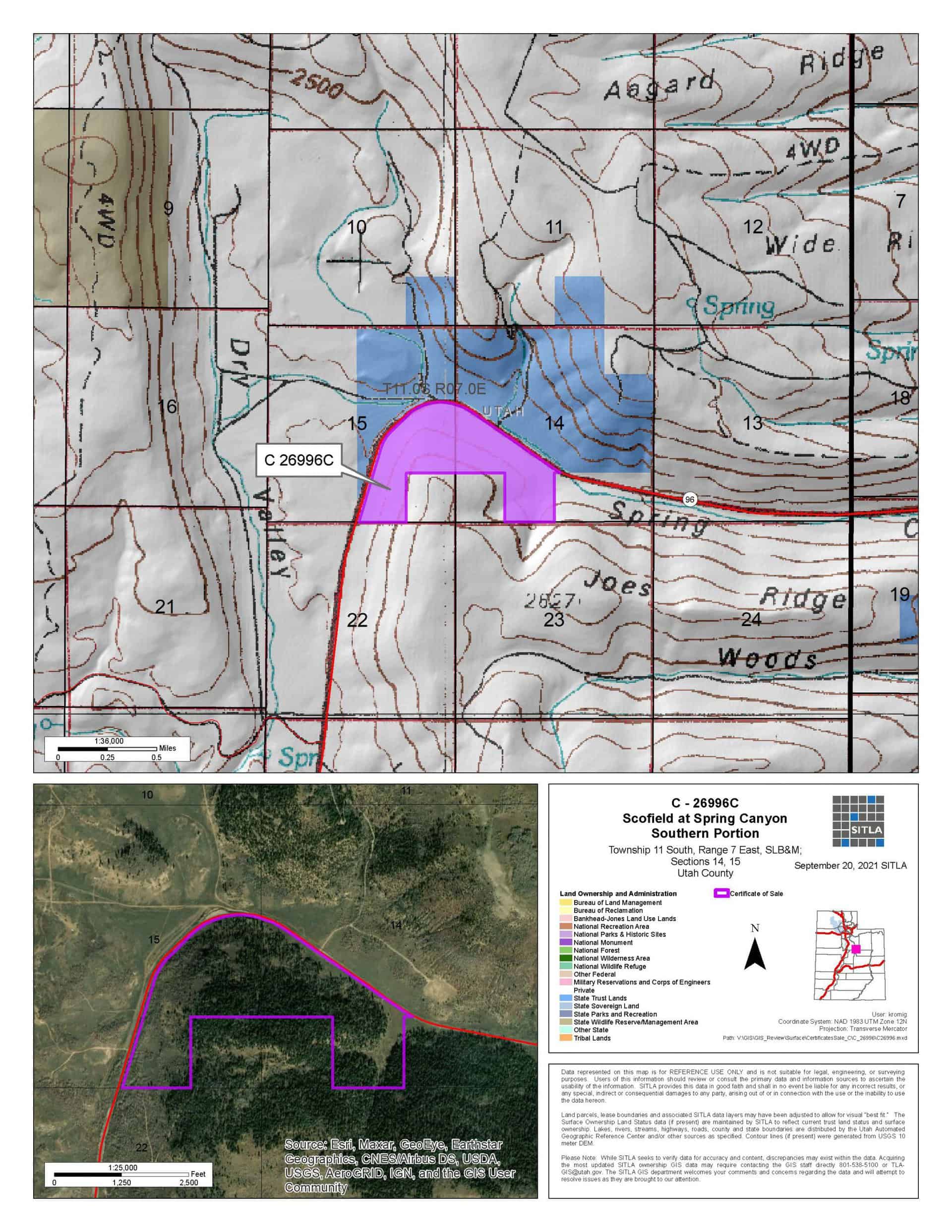
Scofield at Spring Creek – Southern Portion (C-26996-C)
What are trust lands?
Trust lands are parcels of land granted by Congress to Utah at statehood to support specific beneficiaries, including public schools, universities, hospitals, and reservoirs. Trust lands are not public lands, but are generally open for public use, when possible. Trust lands were allocated specifically to generate revenue to support our beneficiaries. SITLA currently manages 3.4 million surface acres on behalf of our beneficiaries.
BIDDING INFORMATION:
Bid Start Time for this Parcel: 8:50am (MDT), June 1, 2022
Bid End Time for this Parcel: 10:50am (MDT), June 7, 2022
Closing Costs:
The closing costs are in addition to the 10% down payment. The cultural resources survey costs may be financed, upon approval. All other closing costs are due from the prevailing bidder at the close of the auction and cannot be financed.
| Cultural Resources Survey: | $4,310.00 |
| Advertising Costs: | $700.00 |
| Appraisal Costs: | $1,190.00 |
| Sale Processing Charge: | $500.00 |
| Application Fee: | $250.00 |
| TOTAL CLOSING COSTS: | $6,950.00 |
Beneficiary:
The net proceeds from the sale of this property will be deposited into the permanent fund for the beneficiary of Public Schools.
Legal Description:
Township 11 South, Range 7 East, SLB&M
Section 14: SE4SW4, Portion of the SW4NW4, N2SW4, and NW4SE4 Lying Southwest of Hwy 96
Section 15: NE4SE4, Portion of the S2NE4 and W2SE4 Lying South and East of Hwy 96
Location:
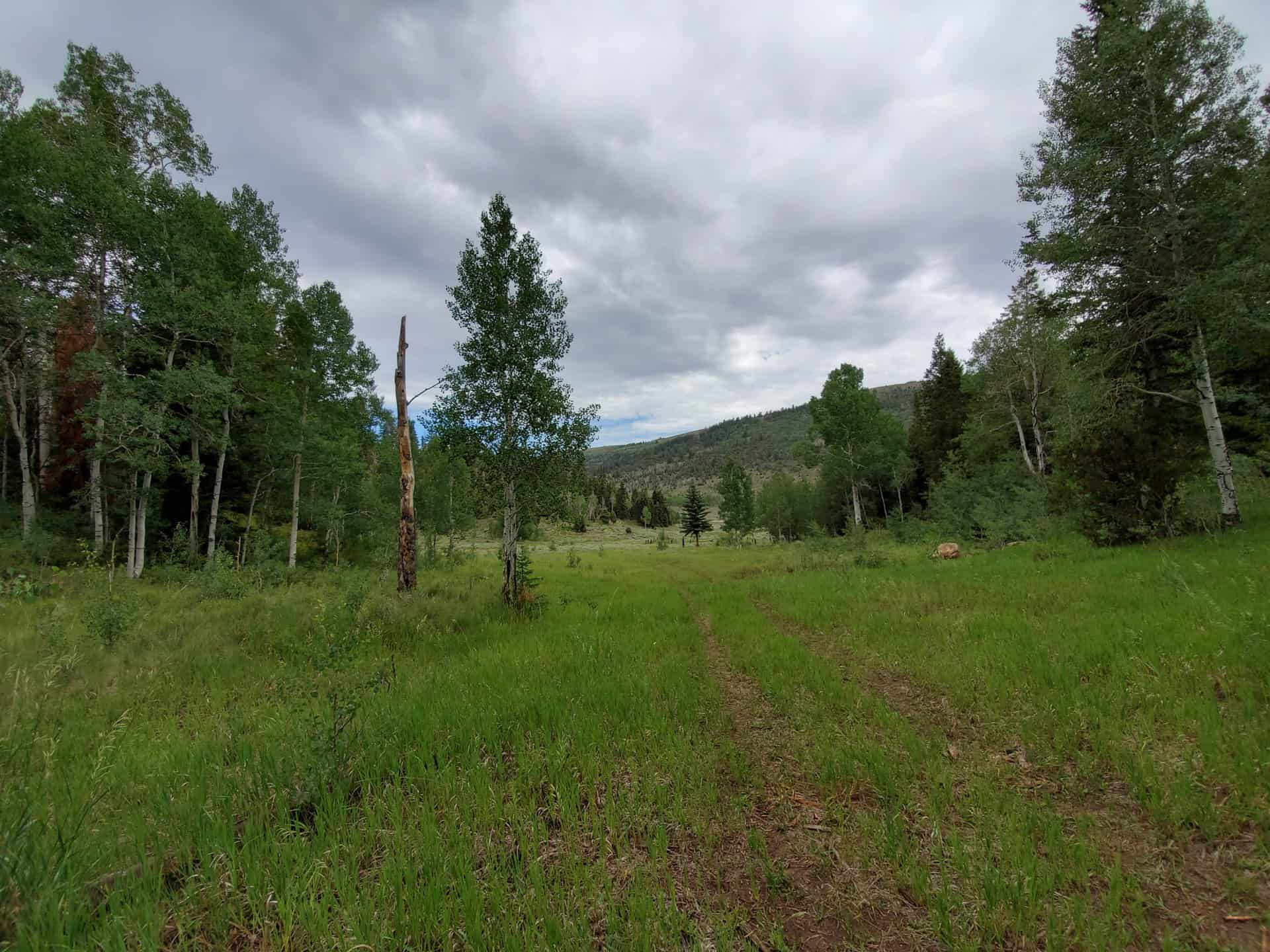
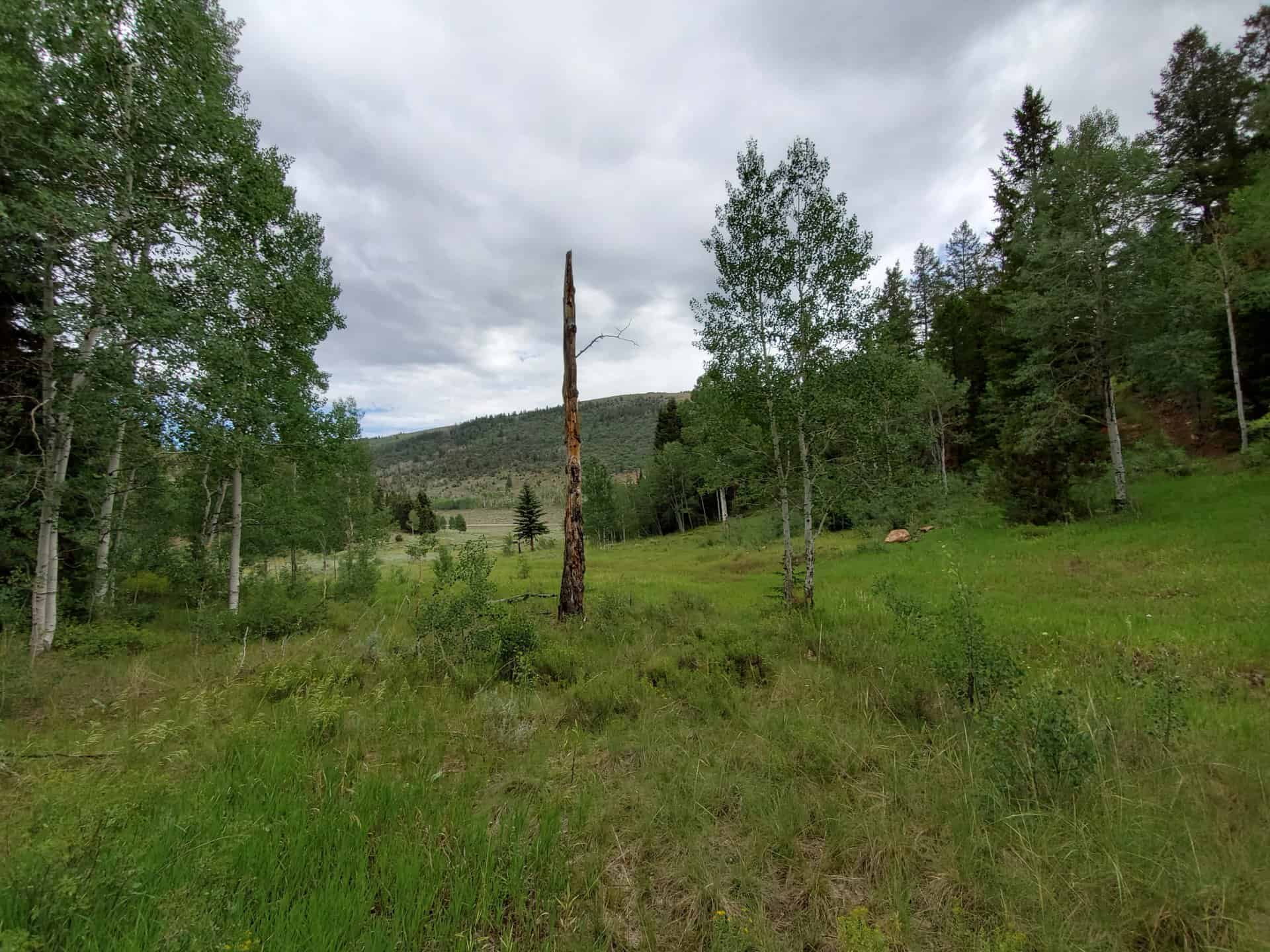
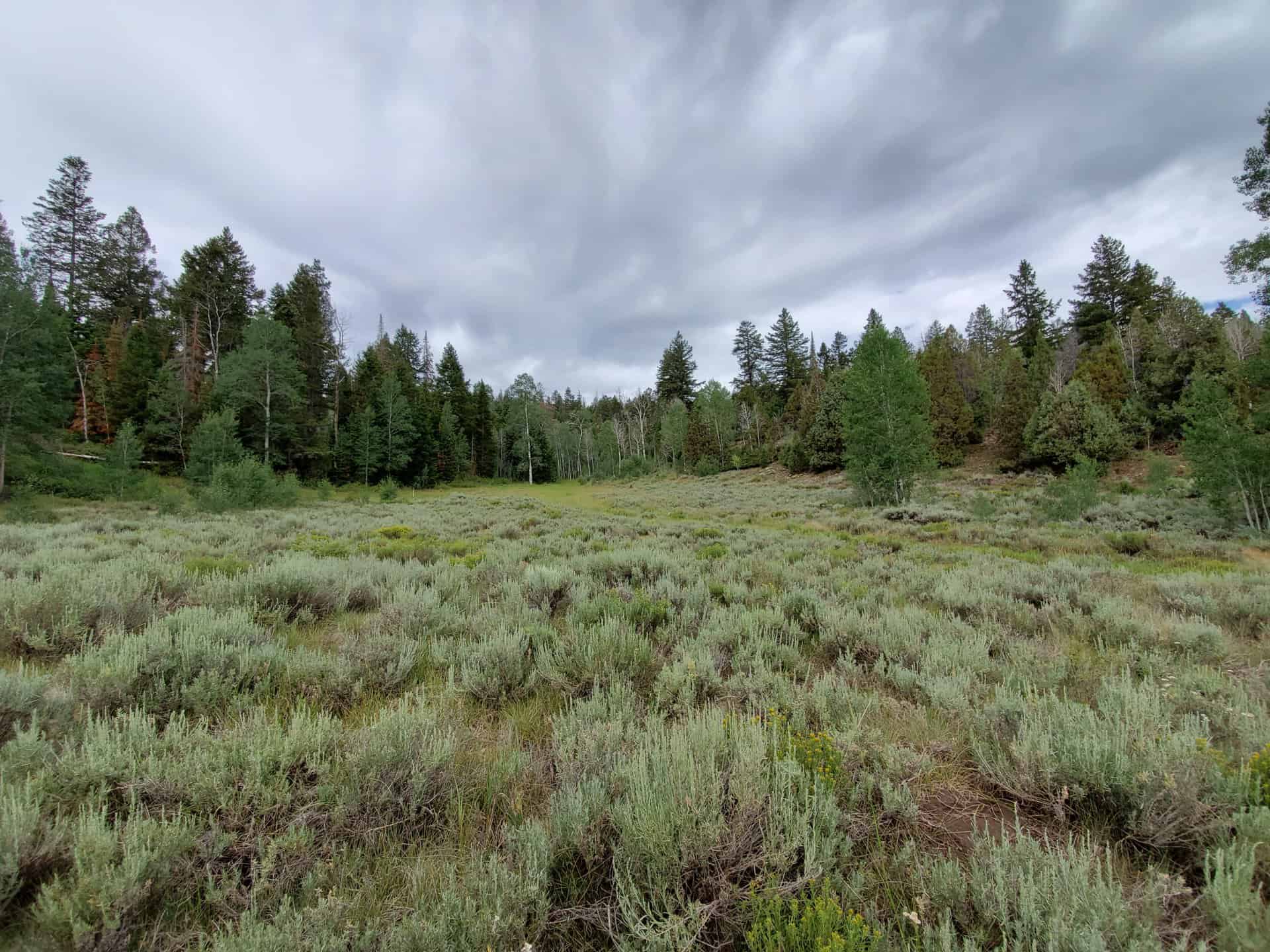
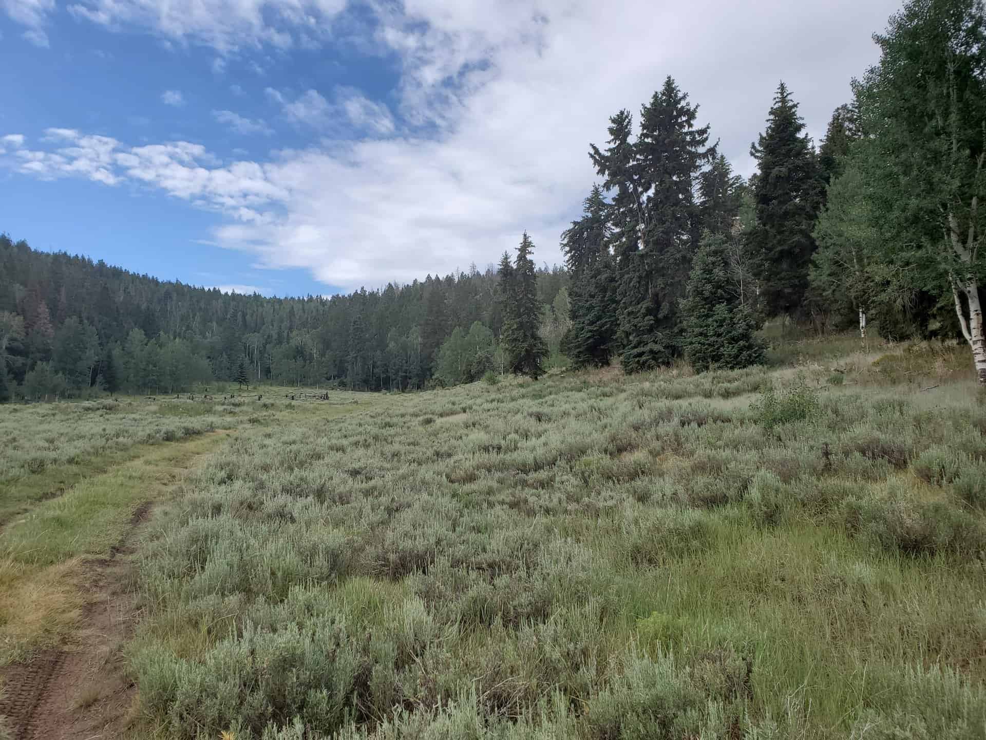
The property is located north of Scofield Reservoir in the Spring Canyon Area, along State Road 96. The parcel is about 35 miles from Provo, Utah. The Scofield Recreation Area is located approximately 3 miles from the western edge of the property.
Access:
Year-round access from the Wasatch Front is on Highway 6 to State Road 96. The parcel has frontage along State Road 96. The eastern edge of the property is approximately 4.4 miles from the turnoff onto State Road 96.
Additional Information:
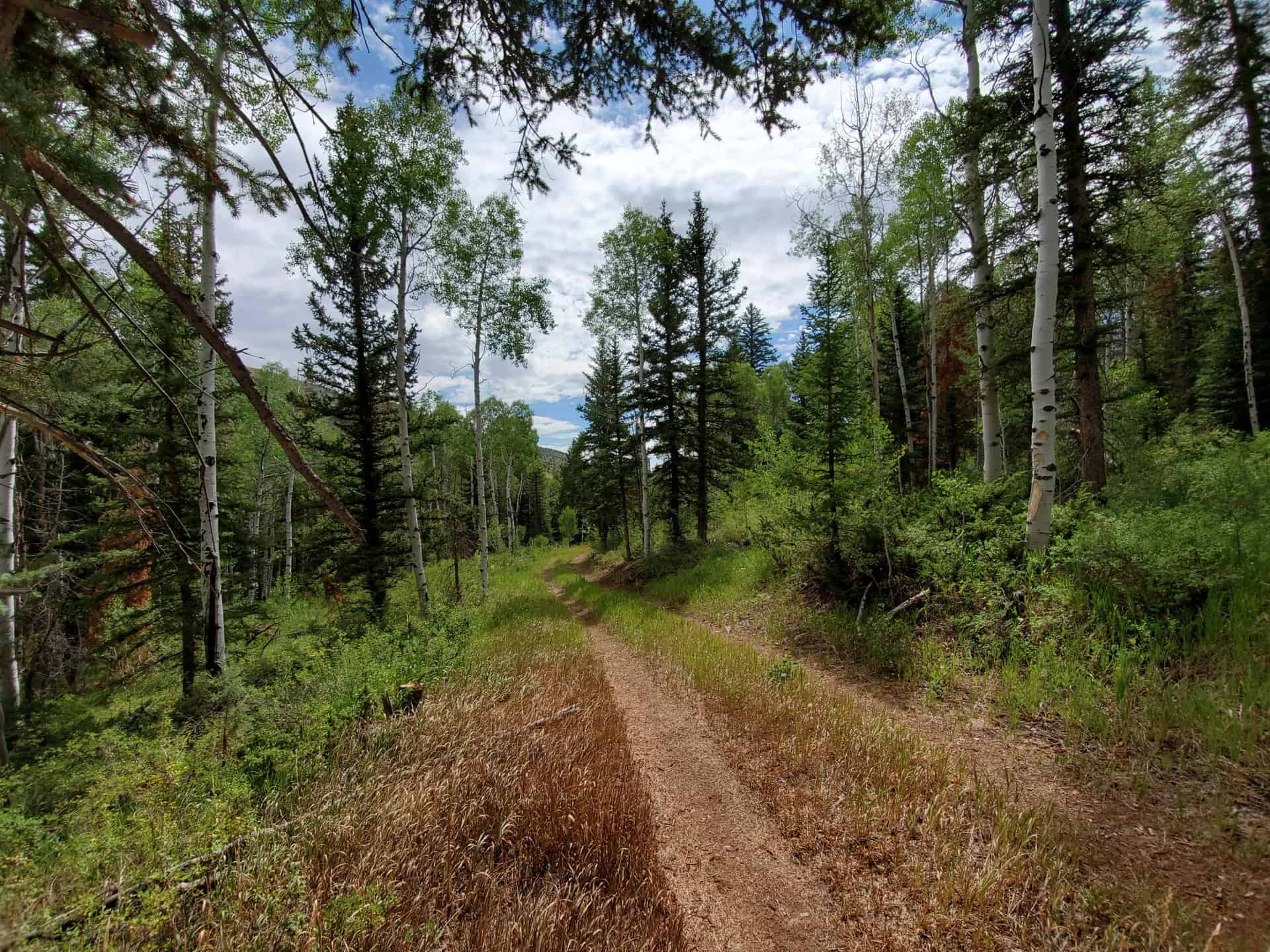
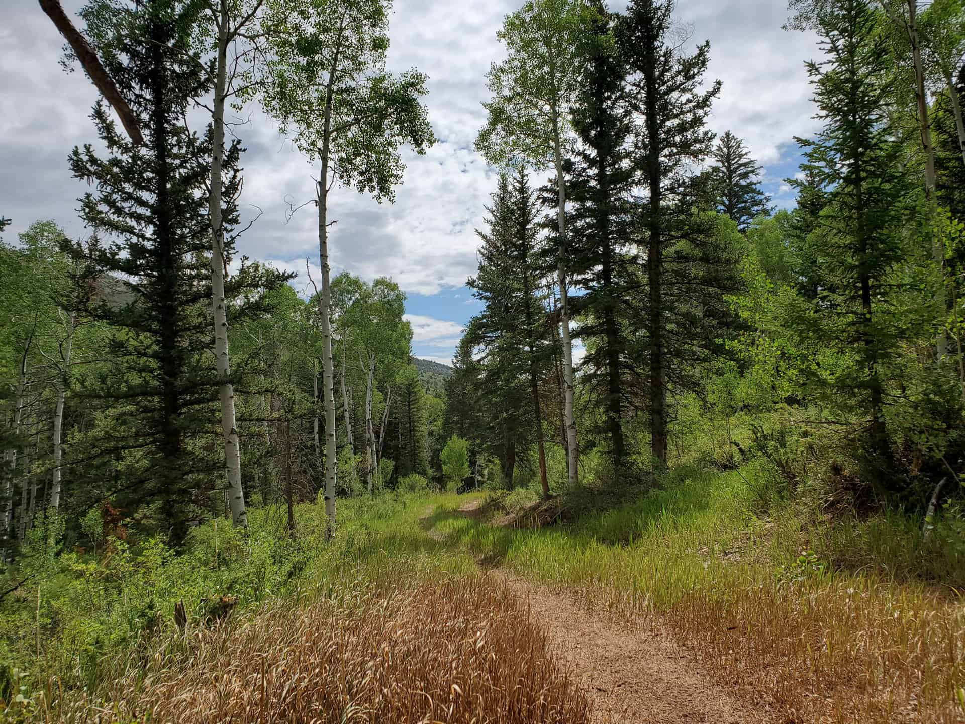
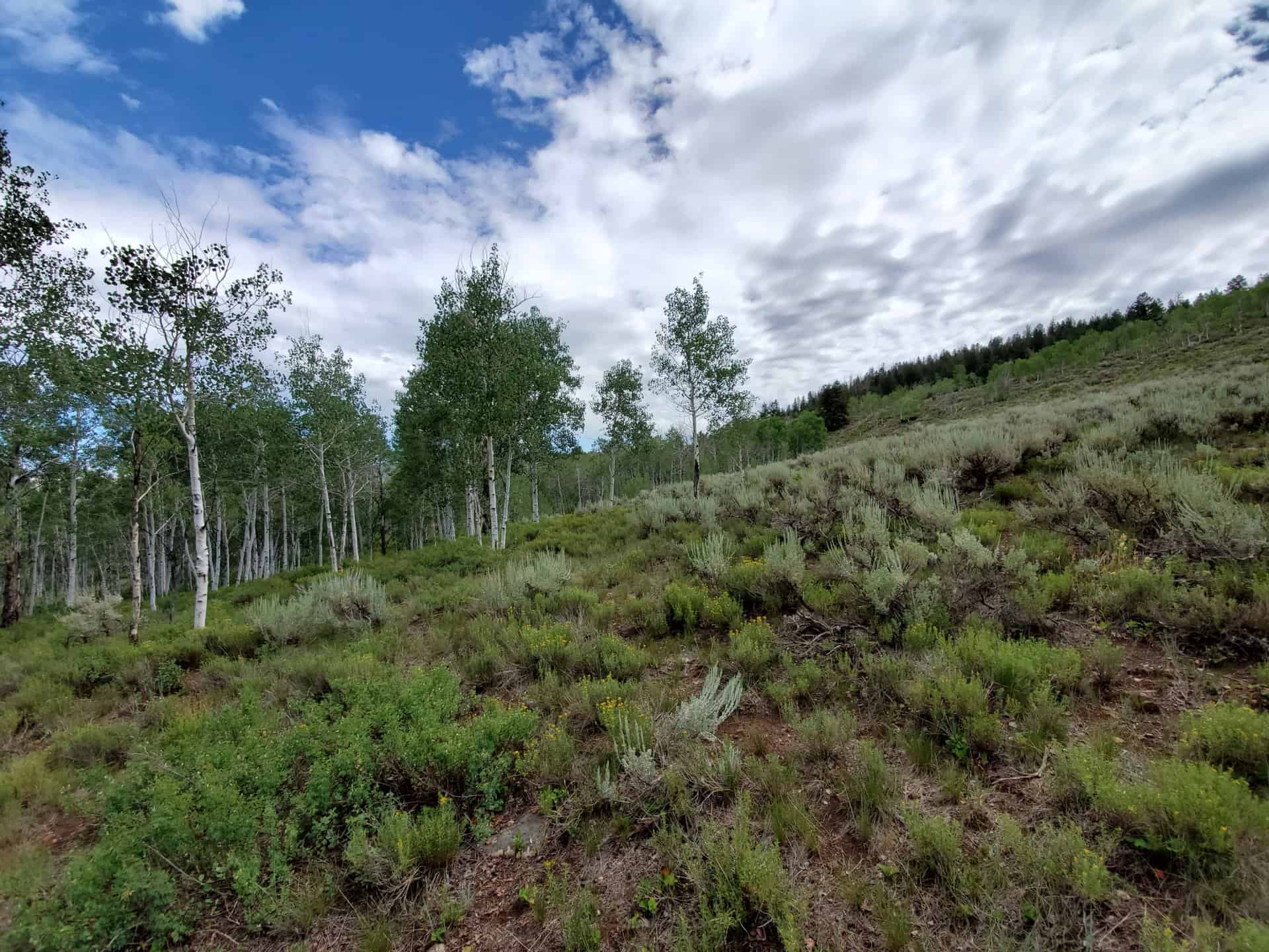
The topography includes near level and moderate to steep hillside. The vegetation is native grasses, sagebrush, aspens, conifers and other deciduous trees and shrubs. Surrounding property is private and SITLA lands. This parcel is located in a popular area with numerous recreation opportunities.
Acreage:
209.44 Acres, More or Less
Water Rights:
No water rights are being sold with this property.
Utilities:
There are no existing utilities in this area.
Zoning:
MG1 (Mining and Grazing 1, with a 50 acre minimum to build)
Financing:
Financing will be offered for this parcel at a variable interest rate of prime plus 2.5% or 7.5%, whichever is greater. A down payment of 10% and closing costs will be due at the auction. The remaining balance can be financed for up to a 20 year term.
Mineral Leases:
None
Surface Leases:
- Grazing Permit No. 20691-11, issued to Joseph Jackson (this property will be deleted from the grazing permit when it is sold)
Cultural Resource Covenant:
A cultural resource survey was conducted on this parcel. No significant sites were identified. The parcel will be sold without any cultural reservations.
Disclosures:
- Please see the disclosure summary and the certificate of sale template document posted at the bottom of this page for general disclosures which apply to all parcels being offered for sale at this auction.
- All mineral rights will be reserved.
- The sand and gravel on the parcel will be subject to a royalty provision if sold commercially.
- The property will be conveyed subject to all valid existing rights.
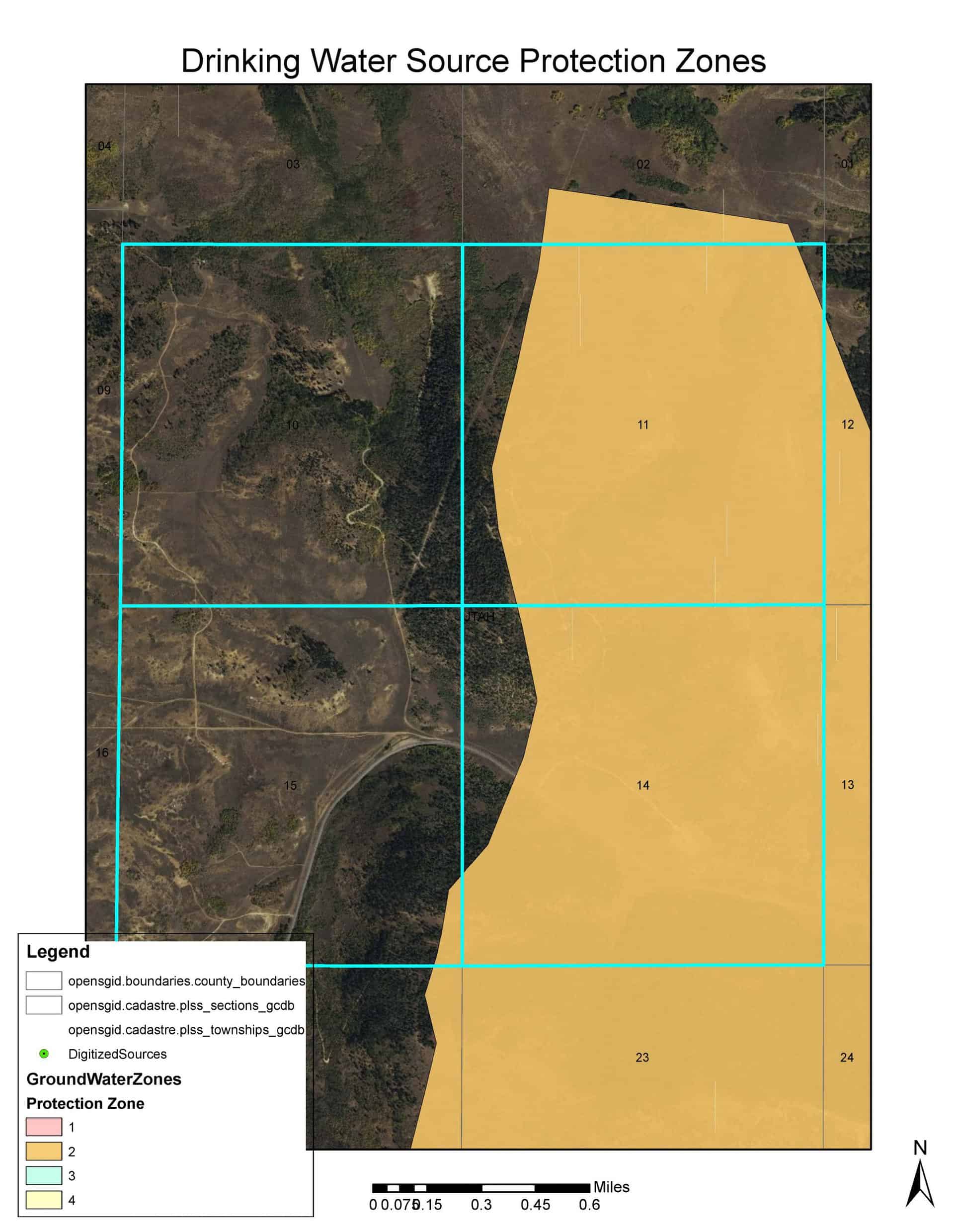
- The Division of Drinking Water has submitted the following comment: “Sensitive Drinking Water Source Protection areas are within the designated sale area. Utah County has a Source Protection Ordinance (Chapter 10-8) that restricts certain development within source protection areas.” (see map for the affected areas)
- The Utah Geological Survey has submitted the following comment: “Potential geologic hazards in the area that could affect the parcel include flash flooding/debris flow, problem soils and/or bedrock including shrink/swell and/or collapsible, landslides and landslide-prone bedrock units, shallow groundwater and/or bedrock, and indoor radon potential. Prospective buyers should be aware of the potential hazards so they can be addressed in a manner appropriate to the intended use of the property. UGS has general geologic hazard information available at its offices and online at http://geology.utah.gov/utahgeo/hazards/index.htm.”

