
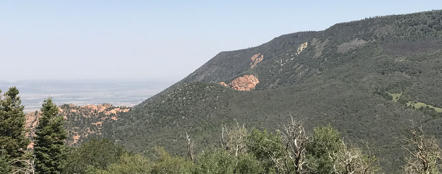


Square Mountain (C-26788)
Closing Costs:
These costs cannot be financed and are in addition to the 10% down payment. All closing costs are due from the prevailing bidder at the auction.
| Appraisal Costs: | $1,900.00 |
| Cultural Resources Survey: | $500.00 |
| Legal Advertising Cost: | $550.00 |
| Sale Processing Charge: | $500.00 |
| Application Fee: | $250.00 |
| TOTAL CLOSING COSTS: | $3,700.00 |
Beneficiary:
Public Schools
Legal Description:
Township 37 South, Range 11 West, SLB&M
Section 2: W2NE4 OF LOT 2, NW4 OF LOT 2, S2 OF LOT 2, LOTS 3-7, W2E2SE4NE4, W2SE4NE4, SW4NE4, SE4NW4, E2SW4, W2NE4NE4SE4, NW4NE4SE4, S2NE4SE4, NW4SE4, S2SE4
Location:
The parcel is located 6 miles southeast of Cedar City, in Iron County. It is surrounded by privately-owned property and BLM property.
Access:
This remote parcel has no current public access.
Other:
The terrain of this property is steep, remote, and mountainous.
Acreage:
616.55 Acres, More or Less
Water:
Water Right No. 73-1689 will be conveyed with this parcel.
Utilities:
There are no known utilities in the general area.
Zoning:
Zoning Code: A-20
Zoning Description: Agriculture 20 Acre Minimum
Zoning Purpose: The agriculture (A-20) district is provided and designed to protect and preserve lands suited for farming, ranching, the production of food and fiber, open space, recreation, services or related purposes and minimal rural estate living, and to protect from encroachment of incompatible uses. Other purposes of this district include protection and enhancement of the economic base of the county, as well as the protection of environmentally sensitive lands, such as areas subject to flooding, wetlands, unstable soils and areas with steep slopes or other geologic conditions. This zone anticipates limited commercial uses that have similar impacts to agricultural uses and provides services in rural areas that are compatible and commensurate with typical commercial agricultural uses.
Financing:
Financing will be offered for this parcel. A down payment of 10% and closing costs will be due at the auction. The remaining balance can be financed at a variable rate of prime plus 2.5% for up to a 20 year term.
Mineral Leases:
None
Surface Leases:
- Grazing Permit No. 23245, issued to the Division of Wildlife Resources (this land will be canceled from this permit when sold)
Cultural Resource Covenant:
A cultural resource survey was conducted on the subject property. No significant sites were identified.
Disclosures:
- Please see the auction page for general disclosures and auction procedure information which pertains to all properties being offered at the auction.
- All mineral rights, including the sand and gravel rights will be reserved.
- The property will be conveyed subject to all valid existing rights.
- The following comment was received from the Utah Geological Survey (UGS): “Potential geologic hazards in the region that could affect the site include landsliding, stream flooding, flash flooding/debris flow, earthquake-related hazards associated with the Hurricane fault, problem soils including shrink/swell and/or collapsible, shallow bedrock, and indoor radon potential. Potential hazards should be addressed in a manner appropriate to the intended use of the property. Geologic hazards are best addressed early in the planning process prior to development and construction. UGS has general geologic hazard information available at its offices and online at http://geology.utah.gov/utahgeo/hazards/index.htm.”
- Other disclosures, if any, will be announced at the auction.

