


Navajo Lake – Southern Parcel (C-27087-B)
What are trust lands?
Trust lands are parcels of land granted by Congress to Utah at statehood to support specific beneficiaries, including public schools, universities, hospitals, and reservoirs. Trust lands are not public lands, but are generally open for public use, when possible. Trust lands were allocated specifically to generate revenue to support our beneficiaries. SITLA currently manages 3.4 million surface acres on behalf of our beneficiaries.
ONLINE BIDDING INFORMATION:
Bid Start Time for this Parcel: 10:10am MST on November 9, 2022
Bid End Time for this Parcel: 11:10am MST on November 15, 2022
Closing Costs:
The closing costs are in addition to the 10% down payment. The cultural resources survey costs may be financed, upon approval. All other closing costs are due from the prevailing bidder at the auction and cannot be financed.
| Appraisal Costs: | $1,100.00 |
| Cultural Resources Survey: | $560.00 |
| Legal Advertising Cost: | $200.00 |
| Sale Processing Charge: | $500.00 |
| Application Fee: | $250.00 |
| TOTAL CLOSING COSTS: | $2,610.00 |
Beneficiary:
The net proceeds from the sale of this property will be deposited into the permanent fund for the beneficiary of Reservoirs.
Legal Description:
Township 38 South, Range 9 West, SLB&M
Section 3: S½NE¼SE¼
Location:
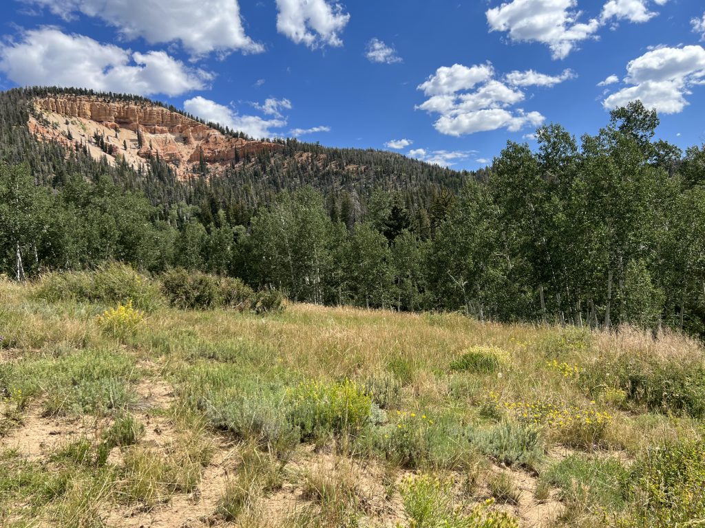
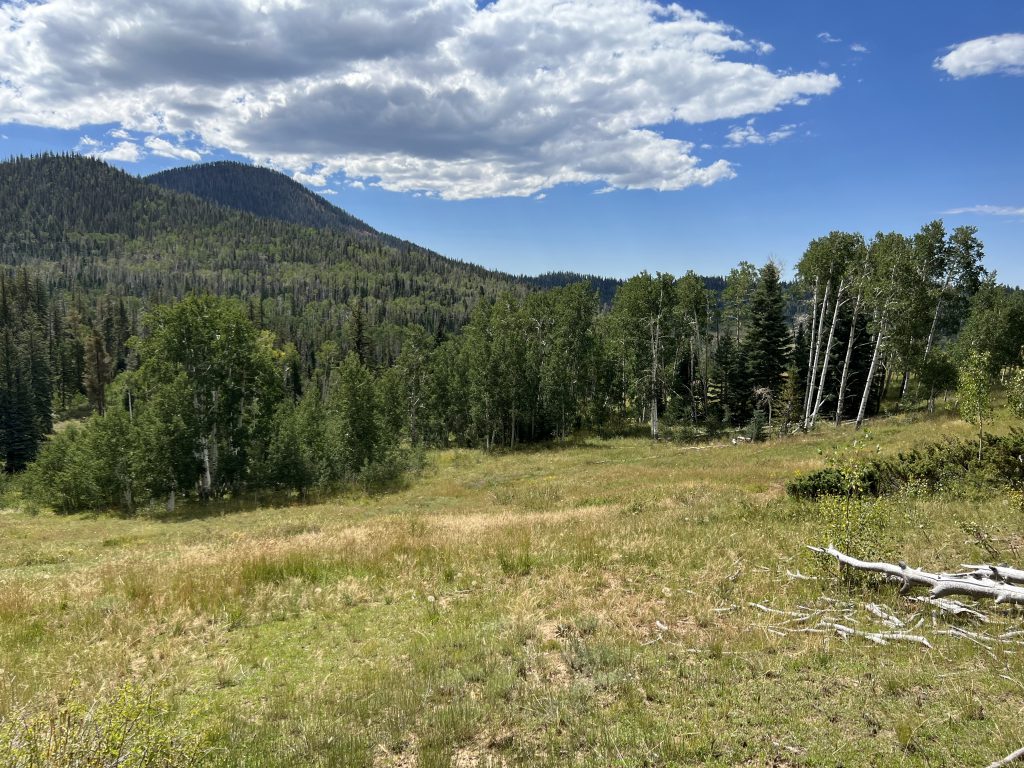
This parcel is located in Kane County – northwest of Navajo Lake.
Access:
Access to the property is northwest from Navajo Lake along North Fork Road and then west along Dixie National Forest Road #1672. This road goes to the southern parcel.
A 40-foot access easement will be reserved from the southern parcel to the northern parcel, along the eastern boundary of the parcel. The road is not yet built to provide access to the northern portion. The purchaser of the northern portion will be responsible for constructing the road.
Additional Information:
The parcel is surrounded by private land to the west and south, SITLA land to the north, and US Forest Service land to the east. The terrain is gentle sloping with many flat areas and clearings suitable for development. The vegetation consists of aspen stands, various species of pine trees, and native brush and grasses. Beautiful views and scenery surround this property.
Acreage:
20.00 acres, more or less
Water Rights:
No water rights will be conveyed with the sale of this property.
Utilities:
No utilities are located on site.
Zoning:
Agriculture – 10 acres
Financing:
Financing will be offered for this parcel at a variable interest rate of prime plus 2.5% or 7.5%, whichever is greater. A down payment of 10% and closing costs will be due at the auction. The remaining balance can be financed for up to a 20 year term.
Mineral Leases:
None
Surface Leases:
- Grazing Permit No. 21639-15, issued to Lundgren Ranch, LLC (when this property is sold, the lands will be deleted from this grazing permit)
- A 40-foot easement will be reserved along the eastern property boundary of C-27057-B (southern parcel) to provide access to C-27057-A (northern parcel). The purchaser of the northern parcel will be responsible for constructing the road. (See the attached map for a depiction of this easement.)
Cultural Resource Covenant:
A cultural resource survey was conducted on this parcel. No significant sites were identified and the property will be sold without any cultural or historical protective deed covenants.
Disclosures:
- Please see the disclosure summary and the certificate of sale template document posted at the bottom of this page for general disclosures which apply to all parcels being offered for sale at this auction.
- All mineral rights will be reserved.
- The sand and gravel on the parcel will be subject to a royalty provision if sold commercially.
- Utah Geological Survey has submitted the following comment: “Potential geologic hazards in the area that could affect the parcel include flash flooding/debris flow, problem soils and/or bedrock including shrink/swell and/or collapsible, shallow bedrock, landslide-prone geologic units, and indoor radon potential. Prospective buyers should be aware of the potential hazards so they can be addressed in a manner appropriate to the intended use of the property. UGS has general geologic hazard information available at its offices and online at http://geology.utah.gov/utahgeo/hazards/index.htm.”
- The property will be conveyed subject to all valid existing rights.

