

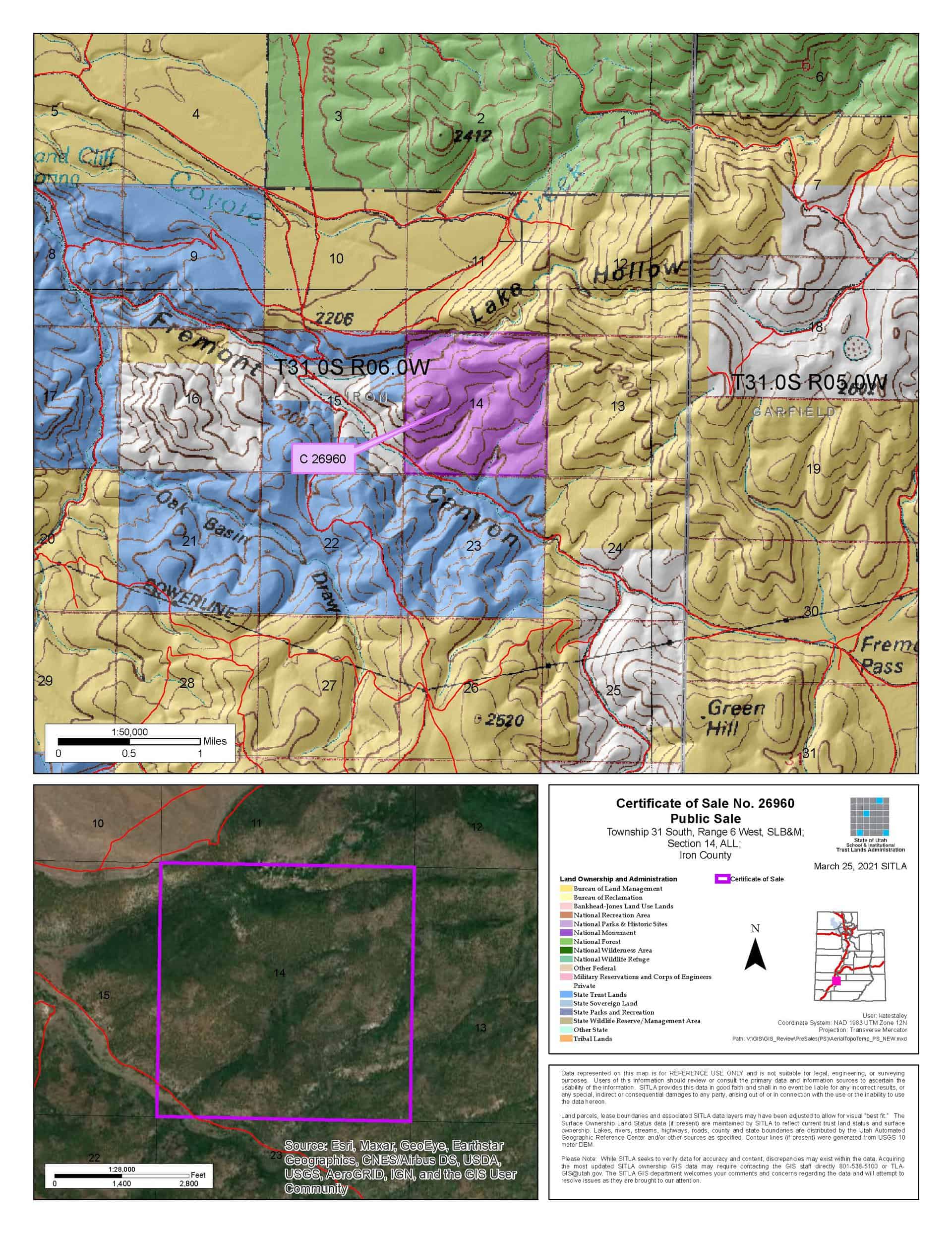
Lake Hollow Parcel (C-26960) (September 2021 Auction)
What are trust lands?
Trust lands are parcels of land granted by Congress to Utah at statehood to support specific beneficiaries, including public schools, universities, hospitals, and reservoirs. Trust lands are not public lands, but are generally open for public use, when possible. Trust lands were allocated specifically to generate revenue to support our beneficiaries. SITLA currently manages 3.4 million surface acres on behalf of our beneficiaries.
ONLINE BIDDING INFORMATION:
Bid Start Time for this Parcel: 9:30am MT, September 8, 2021
Bid End Time for this Parcel: 11:00am MT, September 14, 2021
Closing Costs:
The closing costs are in addition to the 10% down payment. The cultural resources survey costs may be financed, upon approval. All other closing costs are due from the prevailing bidder at the auction and cannot be financed.
| Appraisal Costs: | $700.00 |
| Cultural Resources Survey: | $10,937.60 |
| Legal Advertising Cost: | $100.00 |
| Sale Processing Charge: | $500.00 |
| Application Fee: | $250.00 |
| TOTAL CLOSING COSTS: | $12,487.60 |
Beneficiary:
The net proceeds from the sale of this property will be deposited into the permanent fund for the beneficiary of Public Schools.
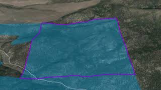
Legal Description:
Township 31 South, Range 6 West, SLB&M
Section 14: All
Location:
This property is located off of Highway 20, along Fremont Road.
Access:
Access to this parcel is from a graveled county-claimed road (Fremont Road). This road runs through the southwest corner of the property. A 4×4 road also runs along the northern property line.
Additional Information:
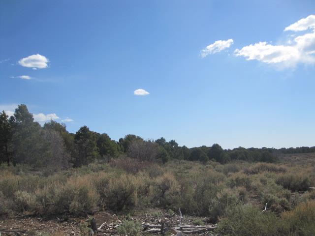
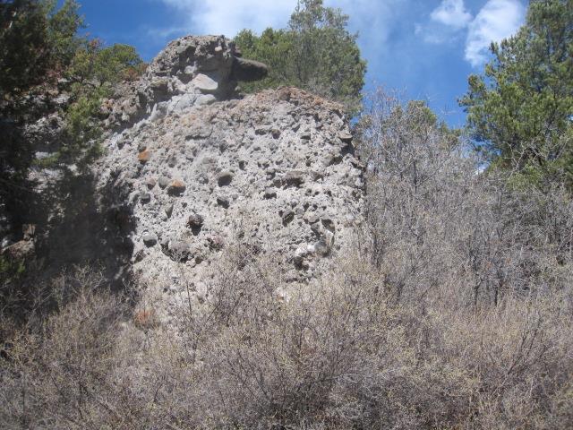
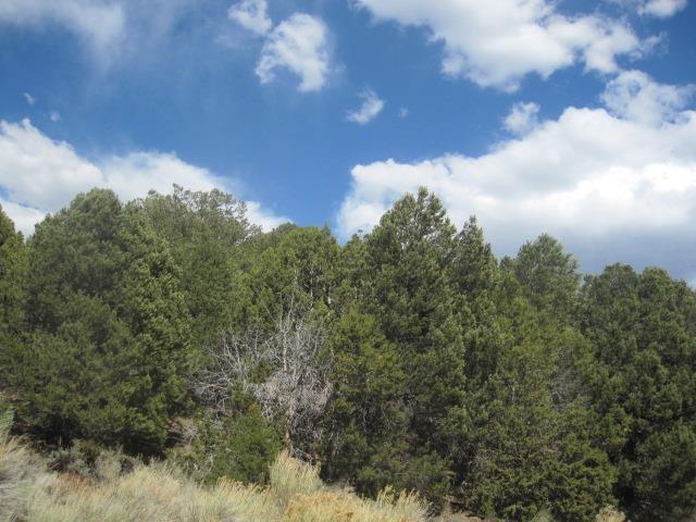
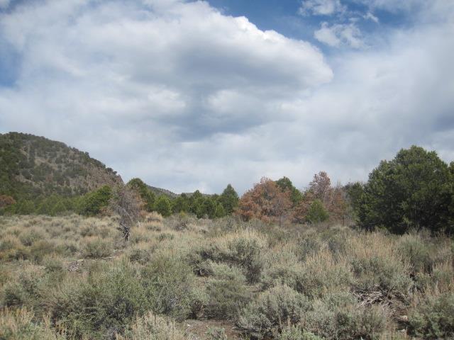
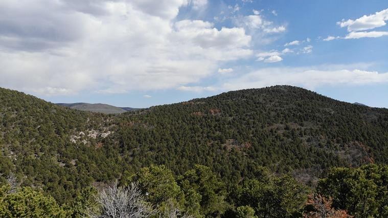
The topography of the property is steep and rocky with thick pinyon and juniper vegetation. The parcel is bordered by BLM lands to the north and east; trust lands to the south and west; and some private lands to the west.
Acreage:
640.00 Acres, More or Less
Water Rights:
This property may include stock watering rights. The purchaser would need to work with the U.S. Bureau of Land Management to determine the amount available, if any, and to correct the records of the Utah State Engineer. More information is available on request.
Utilities:
No utilities are located on the property.
Zoning:
A-20 (Agricultural with a 20 acre minimum lot size to build)
Financing:
Financing will be offered for this parcel at a variable interest rate of prime plus 2.5% or 7.5%, whichever is greater. A down payment of 10% and closing costs will be due at the auction. The remaining balance can be financed for up to a 20 year term.
Mineral Leases:
None
Surface Leases:
- Easement No. 1471, issued to South Central Utah Telephone Association for an underground fiber optics line, with an expiration date of February 28, 2039
- Predesignation No. 753, issued to Iron County for roads which are valid existing rights for a perpetual term
- Grazing Permit No. 22515-10, issued to Beaver Valley Grazing Association (this land will be deleted from the grazing permit when it is sold)
- Grazing Permit No. 22515-A08, issued to Chris Gale (this land will be deleted from the grazing permit when it is sold)
Cultural Resource Covenant:
A cultural resource survey was conducted on this parcel. The parcel will be sold with cultural reservations for the significant site(s) which was identified.
Disclosures:
- Please see the disclosure summary and the certificate of sale template document posted at the bottom of this page for general disclosures which apply to all parcels being offered for sale at this auction.
- All mineral rights will be reserved.
- The sand and gravel on the parcel will be subject to a royalty provision if sold commercially.
- The Utah Geological Survey (UGS) submitted the following comment: “Potential geologic hazards in the area that could affect the property include flash flooding/debris flow, landslides and/or landslide susceptible bedrock, earthquake hazards associated with Quaternary faults in the region, problem soils and/or rock including shrink/swell, and/or collapsible, shallow bedrock, and indoor radon potential. Prospective users should be aware of the potential hazards so they can be addressed in a manner appropriate to the intended use of the property. UGS has general geologic hazard information available at its offices and online at: http://geology.utah.gov/utahgeo/hazards/index.htm.”
- The property will be conveyed subject to all valid existing rights.

