


Crow Creek (C-27076)
What are trust lands?
Trust lands are parcels of land granted by Congress to Utah at statehood to support specific beneficiaries, including public schools, universities, hospitals, and reservoirs. Trust lands are not public lands, but are generally open for public use, when possible. Trust lands were allocated specifically to generate revenue to support our beneficiaries. SITLA currently manages 3.4 million surface acres on behalf of our beneficiaries.
ONLINE BIDDING INFORMATION:
Bid Start Time for this Parcel: 9:30am MST on November 9, 2022
Bid End Time for this Parcel: 10:30am MST on November 15, 2022
Closing Costs:
The closing costs are in addition to the 10% down payment. The cultural resources survey costs may be financed, upon approval. All other closing costs are due from the prevailing bidder at the auction and cannot be financed.
| Appraisal Costs: | $2,700.00 |
| Cultural Resources Survey: | $3,594.00 |
| Legal Advertising Cost: | $400.00 |
| Sale Processing Charge: | $500.00 |
| Application Fee: | $250.00 |
| TOTAL CLOSING COSTS: | $7,444.00 |
Beneficiary:
The net proceeds from the sale of this property will be deposited into the permanent fund for the beneficiaries of Public Schools and Reservoirs.
Legal Description:
Township 3 South, Range 19 East, SLB&M
Section 8: SE¼SE¼
Section 16: W½W½
Location:
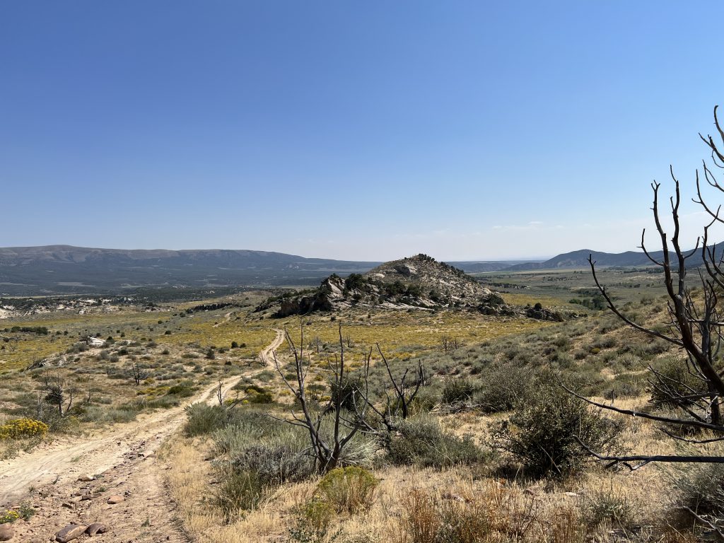
This parcel is located in Uintah County, east of Paradise Park Road and north of the Treaty Line Road in the Deep Creek area.
Access:
No legal access. Physical access is possible but proper legal permission must be obtained from adjoining landowner(s).
Additional Information:
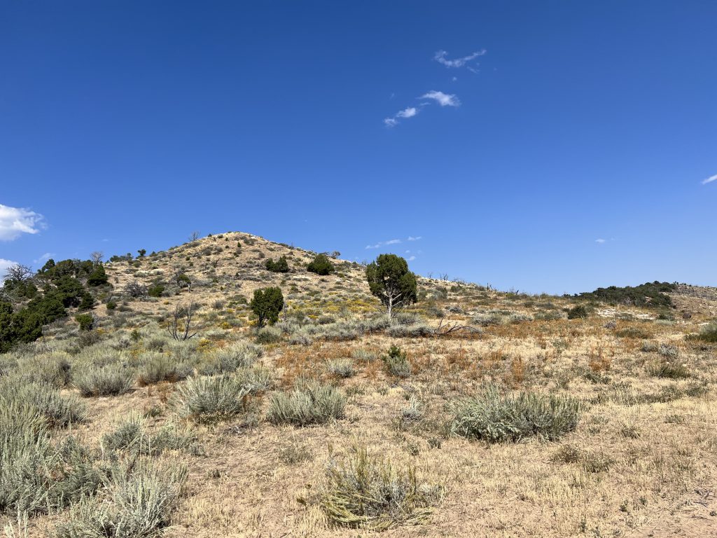
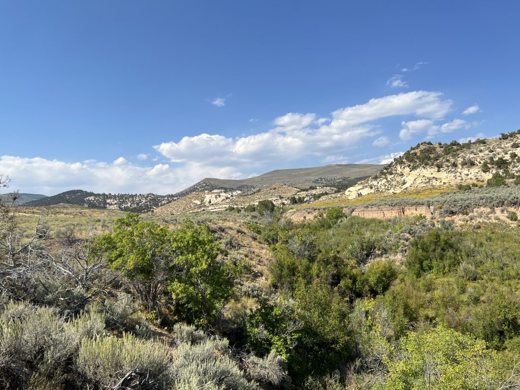
The property is divided into two parcels. There is a 40-acre parcel that is northwest of the main 160-acre parcel. The 40-acre parcel is surrounded by BLM land except to the south where it is bordered by private property. The 160-acre parcel borders private property to the west and south. BLM and SITLA properties are to the north and east respectively. Crow Creek runs through portions of both parcels. The vegetation consists of native trees, brushes, and grasses. Most of the northern portions of the property are wooded in Juniper trees. The terrain includes a creek bottom, sagebrush flats, sandstone ridges, and rolling hills.
Acreage:
200.00 acres, more or less
Water Rights:
There are no water rights associated with this parcel.
Utilities:
There are no utilities on this parcel.
Zoning:
RFM – Recreation, Forestry & Mining
Financing:
Financing will be offered for this parcel at a variable interest rate of prime plus 2.5% or 7.5%, whichever is greater. A down payment of 10% and closing costs will be due at the auction. The remaining balance can be financed for up to a 20 year term.
Mineral Leases:
None
Surface Leases:
- Grazing Permit No. 22126-08, issued to Wayne and Michelle Miles (when the property is sold, the lands will be removed from this grazing permit)
- Easement No. 2575 will be issued for access across existing roads (a map will be posted soon showing this reservation)
- An access easement will be reserved across existing roads to provide access to trust lands located to the east of the property (see attached map for a depiction of this reservation)
- SITLA hereby reserves a perpetual non-exclusive easement across the SE4SE4 of Section 8, Township 3 South, Range 19 East, SLB&M (the “Burdened Property”) for SITLA or its permittees to trail livestock and to access those trust lands located within the SW4NE4 and NW4SE4 of Section 8, Township 3 South, Range 19 East, SLB&M (the “Benefited Property”). SITLA or its permittees may use the easement for non-motorized access to the Benefited Property to maintain the Benefited Property for livestock grazing and to maintain the livestock that are grazing on the Benefitted Property and the adjacent federal grazing unit. This easement covers the entire 40 acres; however, SITLA and its permittees shall take reasonable measures to limit the impact of the livestock and to prevent unreasonable damage to the Burdened Property.
Cultural Resource Covenant:
A cultural resource survey was conducted on this parcel. No significant historic or cultural sites were identified. The property will be sold without any historic or cultural covenants.
Disclosures:
- Please see the disclosure summary and the certificate of sale template document posted at the bottom of this page for general disclosures which apply to all parcels being offered for sale at this auction.
- All mineral rights will be reserved.
- The sand and gravel on the parcel will be subject to a royalty provision if sold commercially.
- The Utah Geological Survey has submitted the following comment: “Potential geologic hazards in the area that could affect the parcels include landslides and landslide-prone geologic units, flash flooding/debris flow, problem soils and/or bedrock including shrink/swell and/or collapsible, shallow bedrock, and indoor radon potential. Prospective buyers should be aware of the potential hazards so they can be addressed in a manner appropriate to the intended use of the property. The UGS has general geologic hazard information available at our offices and online at
http://geology.utah.gov/utahgeo/hazards/index.htm.” - The property will be conveyed subject to all valid existing rights.

