


Coal Mine Basin (C-26887)
ONLINE BIDDING INFORMATION:
Bid Start Time: Thursday, November 12, 2020 at 9:10am
Bid End Time: Wednesday, November 18, 2020 at 2:10pm
Closing Costs:
These costs cannot be financed and are in addition to the 10% down payment. All closing costs are due from the prevailing bidder at the auction.
| Appraisal Costs: | $2,300.00 |
| Cultural Resources Survey: | $564.00 |
| Legal Advertising Cost: | $550.00 |
| Land Survey Cost: | $2,000.00 |
| Sale Processing Charge: | $500.00 |
| Application Fee: | $250.00 |
| TOTAL CLOSING COSTS: | $6,164.00 |
Beneficiary:
The net proceeds from the sale of this property will be deposited into the permanent fund for the beneficiary of Public Schools.
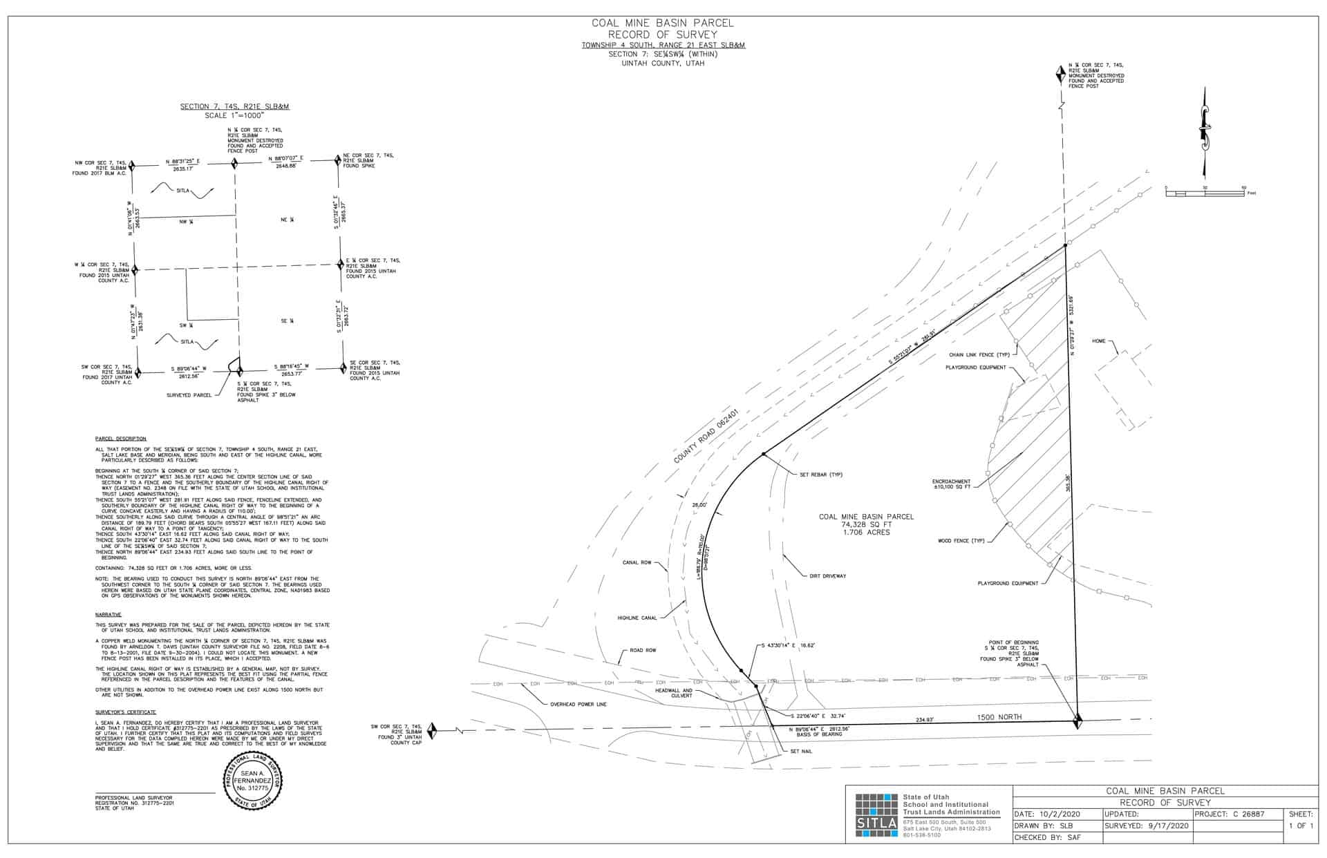
Legal Description:
Township 4 North, Range 21 East, SLB&M
Section 7: Portion of SE¼SW¼ Being SE of Highline Canal
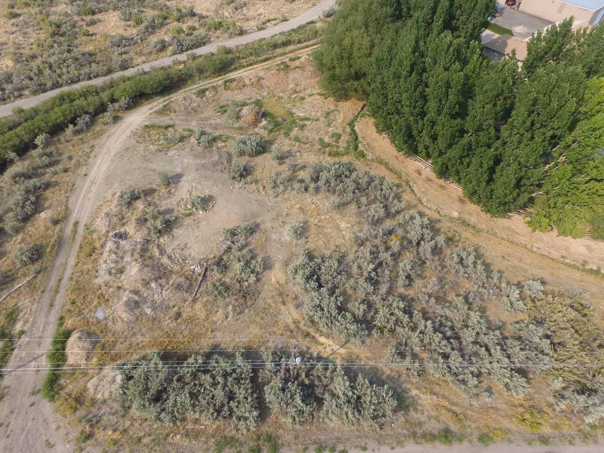
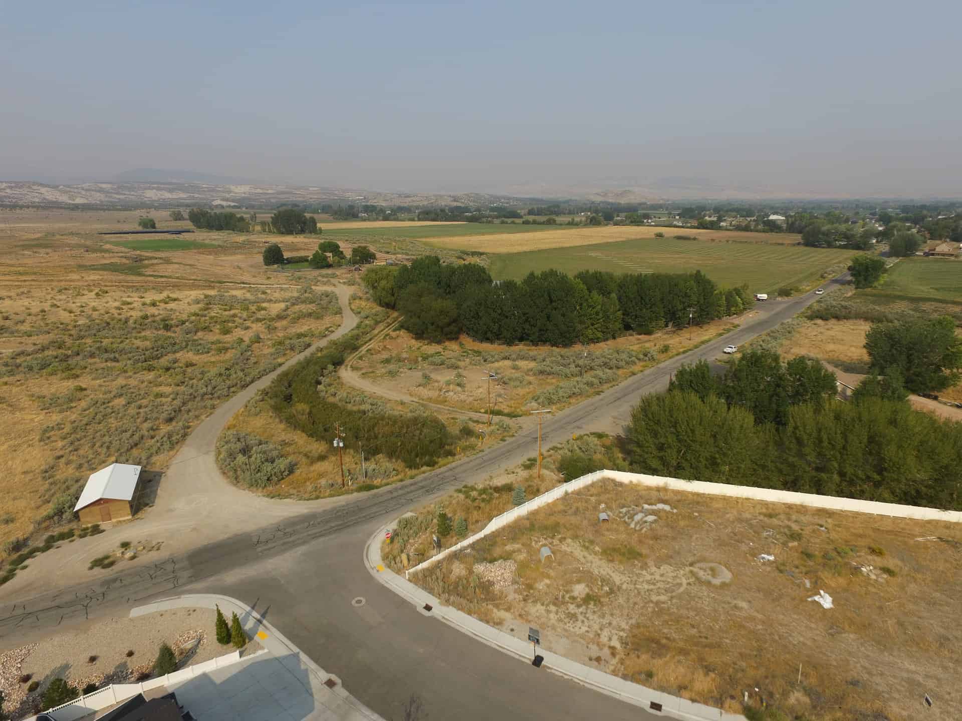
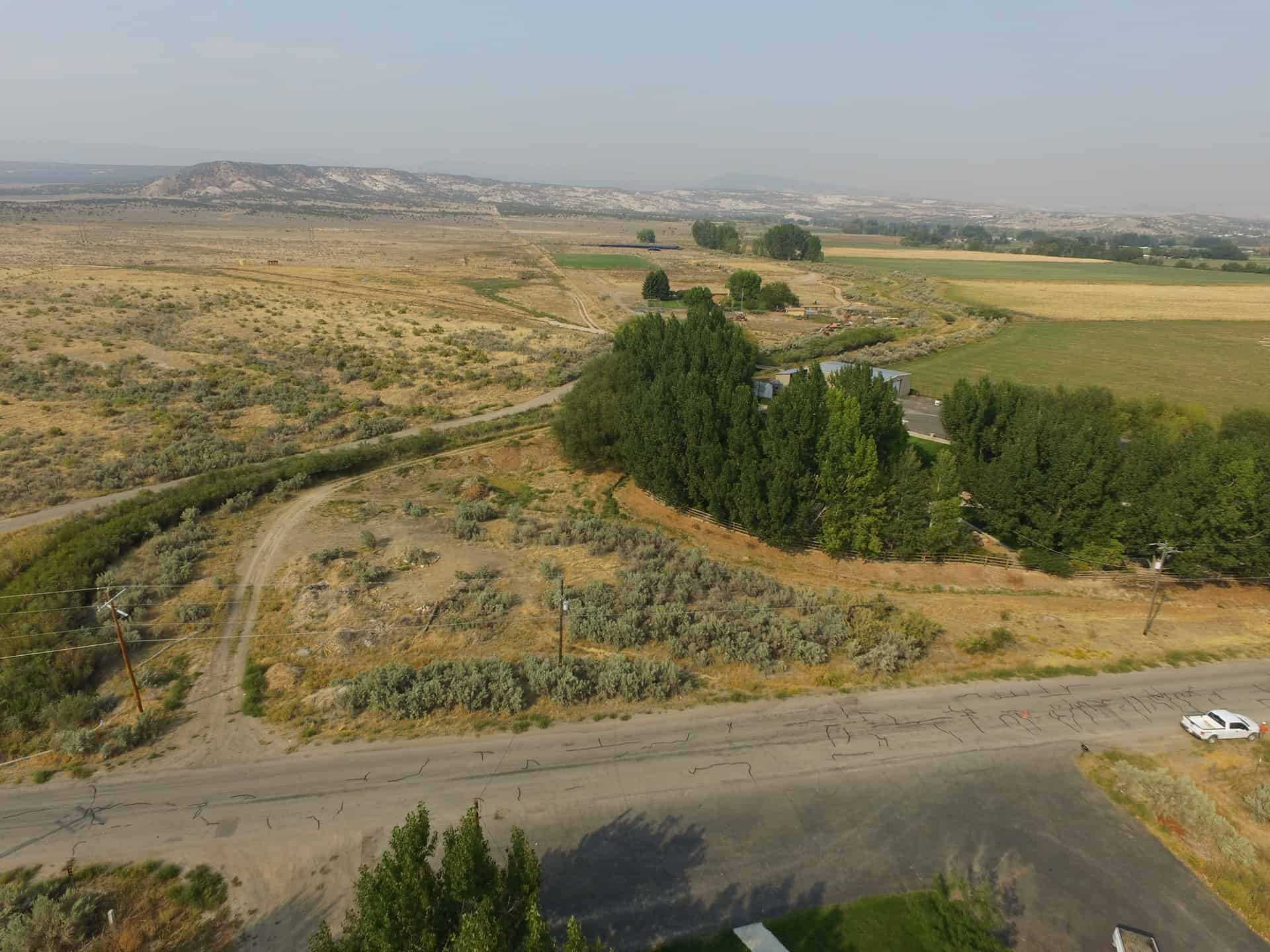
Location:
The parcel is located approximately 4 miles northwest of Vernal. The Highline Canal is located to the northwest of the parcel and 1500 North is located to the south of the parcel.
Access:
Access to and through the parcel is via 1500 North.
Other:
This remnant parcel is bordered on the east and south by private property. The landowner to the east has encroached slightly onto the property with some landscaping.
Acreage:
1.70 Acres, More or Less
Water:
None
Utilities:
Power, sewer, water, and telephone appear to be located within 1500 North. Interested parties should verify availability.
Zoning:
RA1 – Residential Agricultural
Financing:
Financing will be offered for this parcel. A down payment of 10% and closing costs will be due at the auction. The remaining balance can be financed at a variable rate of prime plus 2.5% for up to a 20 year term.
Mineral Leases:
None
Surface Leases:
- Easement No. 2348, issued to High Line Canal Company for a canal for a perpetual term
- Right of Way No. 2542, issued to Ashley Valley Water & Sewer for a buried water pipeline for a perpetual term
- Grazing Permit No. 20993-12, issued to the Hacking Land and Livestock (this acreage will be deleted from the permit upon sale of the property)
Cultural Resource Covenant:
A cultural resource survey was conducted on this property. No significant sites were located. The property with be sold without any cultural resource reservations.
Disclosures:
- Please see the disclosure summary and the certificate of sale template document posted at the bottom of this page for general disclosures which apply to all parcels being offered for sale at this auction.
- All mineral rights, including the sand and gravel rights will be reserved.
- The property will be conveyed subject to all valid existing rights.
- The Utah Geologic Survey has commented: Potential geologic hazards in the area that could affect the property include flash flooding/debris flow, problem soils including shrink/swell and/or collapsible, wind-blown sand, shallow bedrock, and indoor radon potential. Prospective users should be aware of the potential hazards so they can be addressed in a manner appropriate to the intended use of the property. UGS has general geologic hazard information available at its offices and online at http://geology.utah.gov/utahgeo/hazards/index.htm.

