
Anderson Hollow (C-27164)
What are trust lands?
Trust lands are parcels of land granted by Congress to Utah at statehood to support specific beneficiaries, including public schools, universities, hospitals, and reservoirs. Trust lands are not public lands, but are generally open for public use, when possible. Trust lands were allocated specifically to generate revenue to support our beneficiaries. SITLA currently manages 3.3 million surface acres on behalf of our beneficiaries.
ONLINE BIDDING INFORMATION:
Bid Start Time for this Parcel: November 8, 2023, Time: 8:00am MST
Bid End Time for this Parcel: November 14, 2023, Time: 10:00am MST
- To register as a bidder or to place a bid, please see box to the right.
CLOSING COSTS:
The closing costs are in addition to the 10% down payment. All closing costs are due from the prevailing bidder at the auction and cannot be financed.
| Appraisal Costs: | $1,700.00 |
| Cultural Resources Survey: | $914.39 |
| Legal Advertising Cost: | $600.00 |
| Sale Processing Charge: | $750.00 |
| TOTAL CLOSING COSTS: | $3,964.39 |
Beneficiary:
The net proceeds from the sale of this property will be deposited into the permanent fund for the beneficiary of Public Schools.
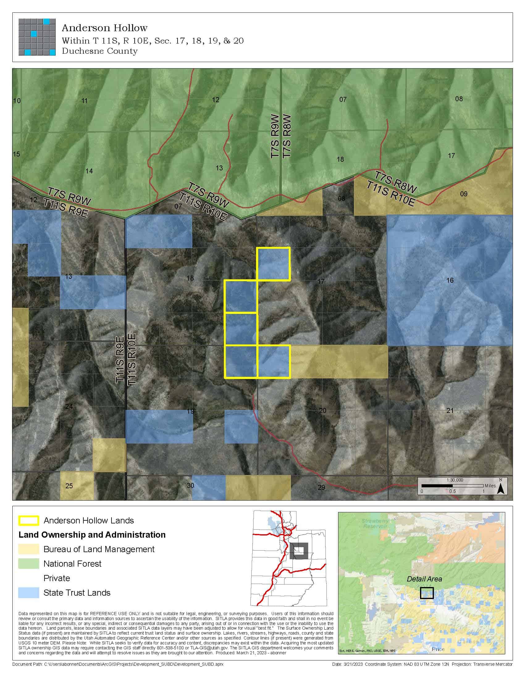
Legal Description:
Township 11 South, Range 10 East, SLB&M
Section 17: SW¼NW¼
Section 18: E½SE¼
Section 19: NE¼NE¼
Section 20: NW¼NW¼
Location:
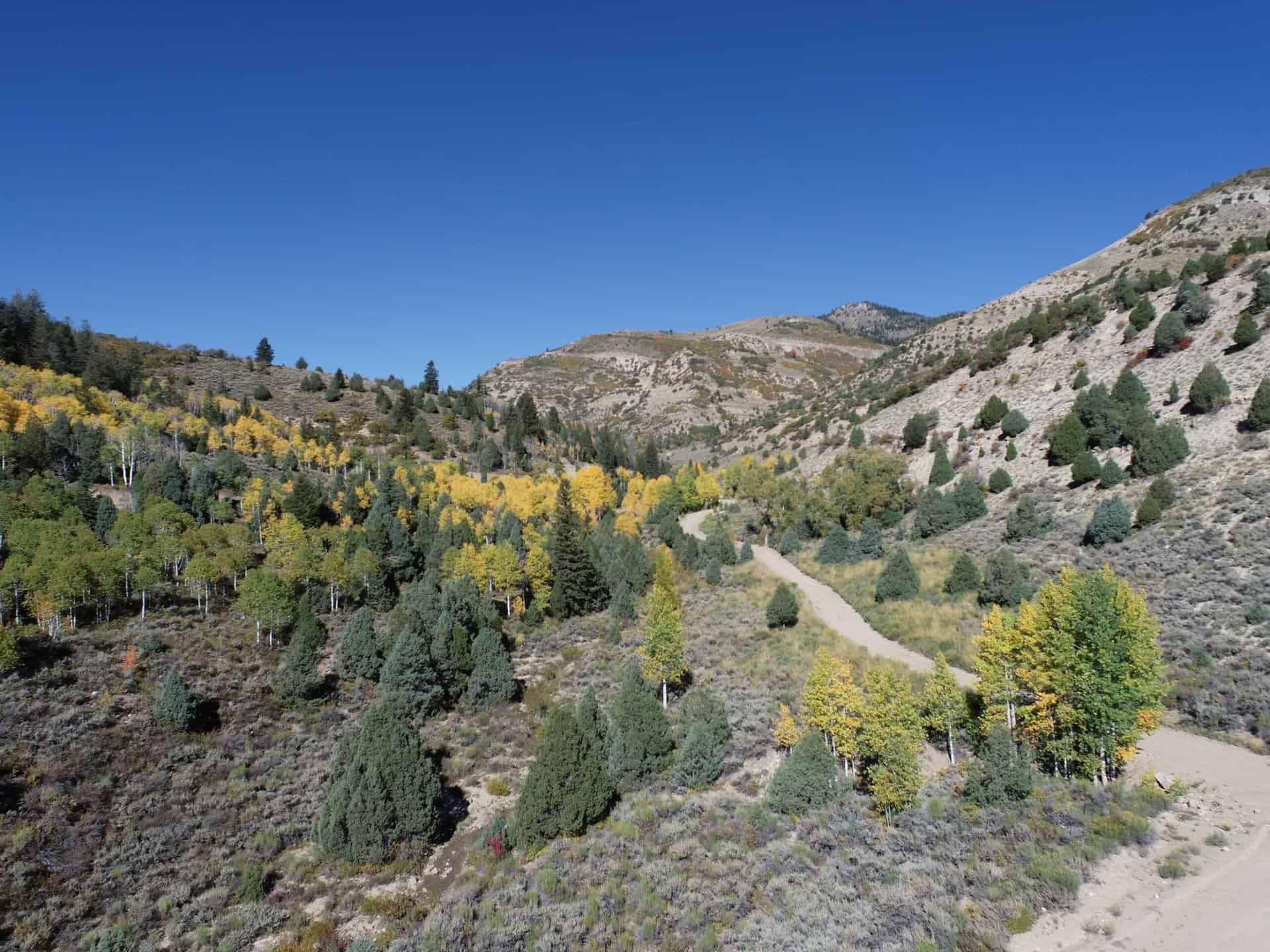
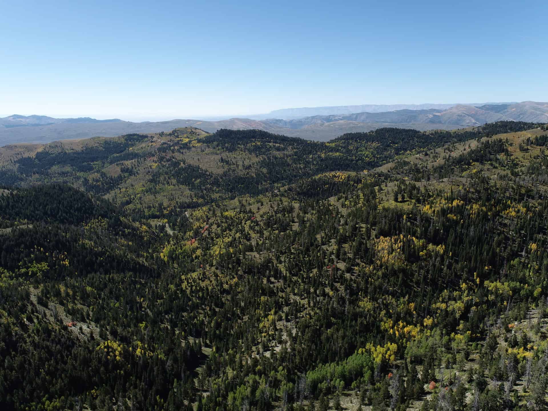
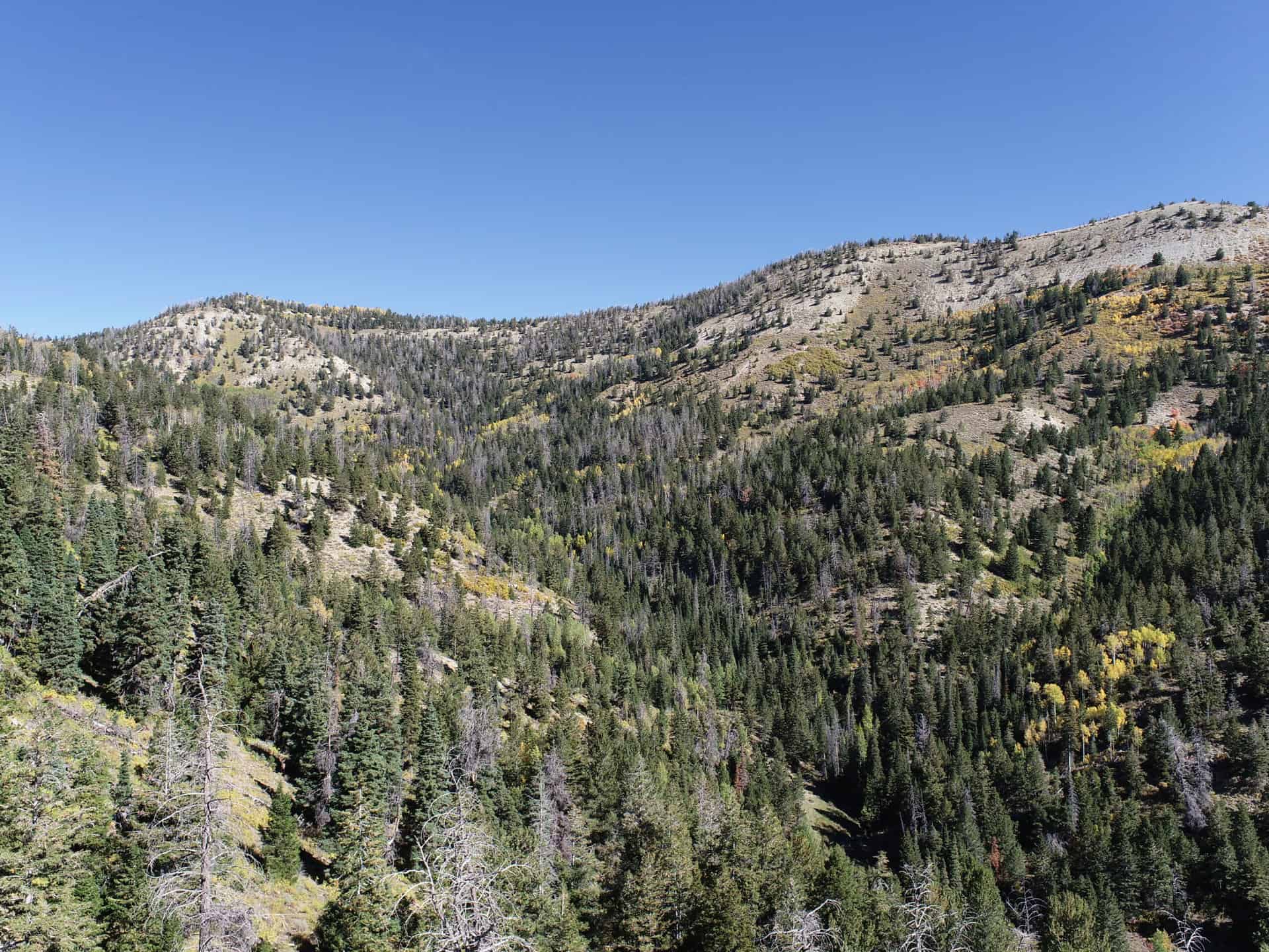
This parcel is located on Reservation Ridge in southern Duchesne County, about 5 miles north of the Emma Park Road and Highway 191 Junction.
Access:
The property is surrounded by private landowners. Interested parties would need to obtain access from one of the surrounding landowners.
Additional Information:
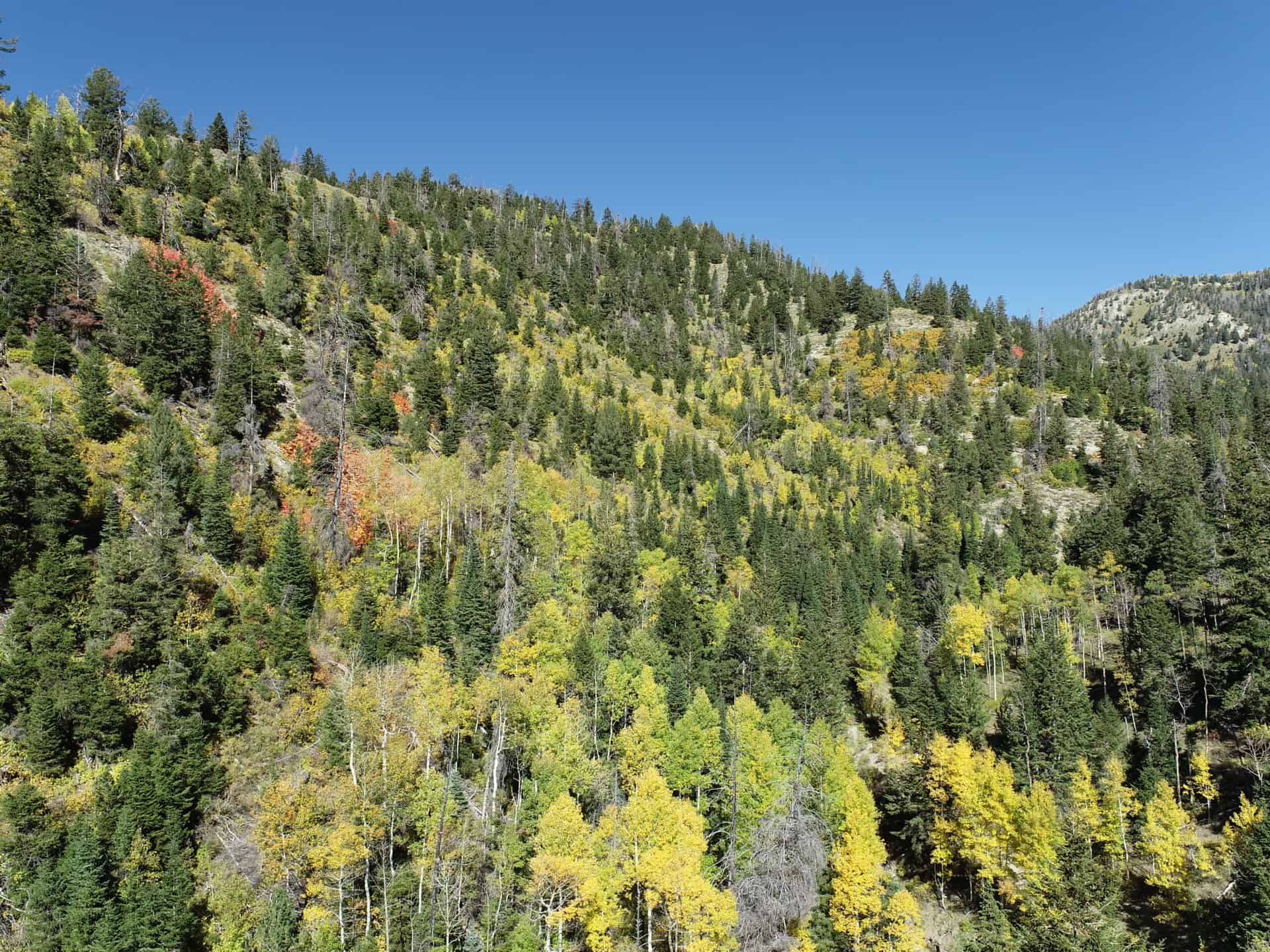
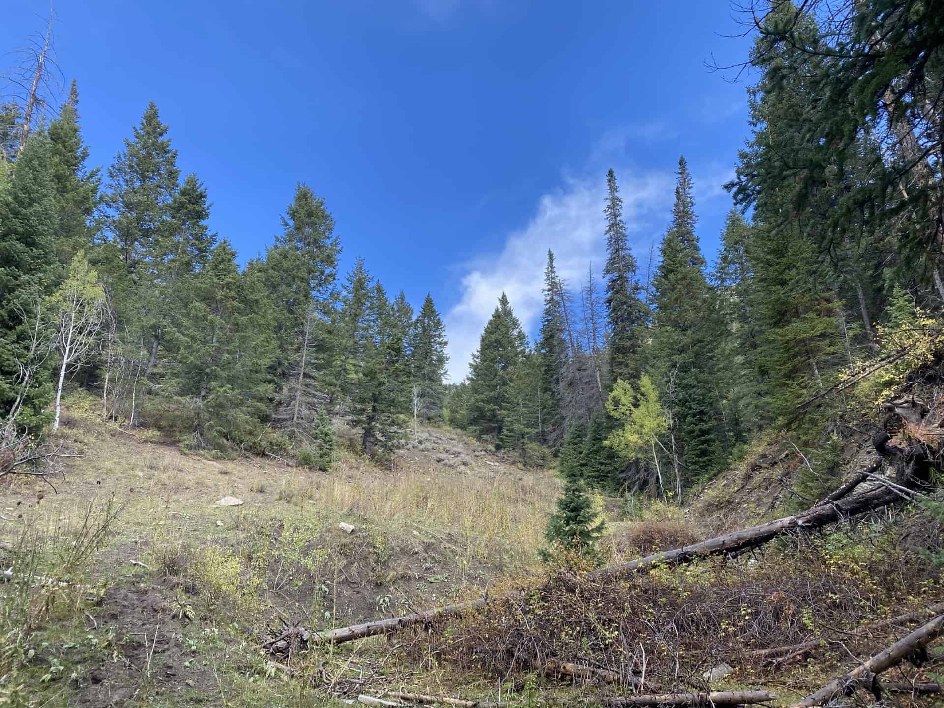
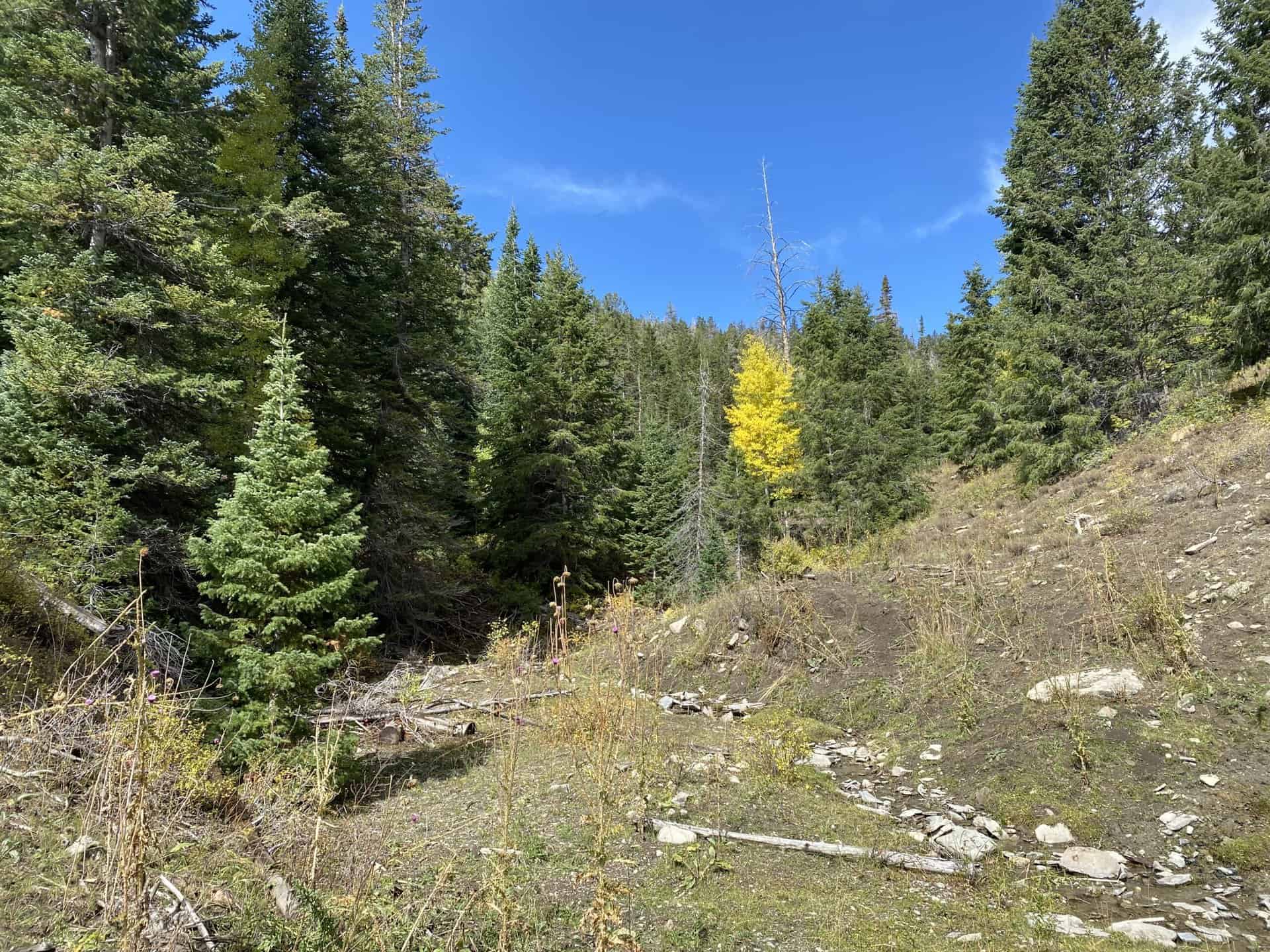
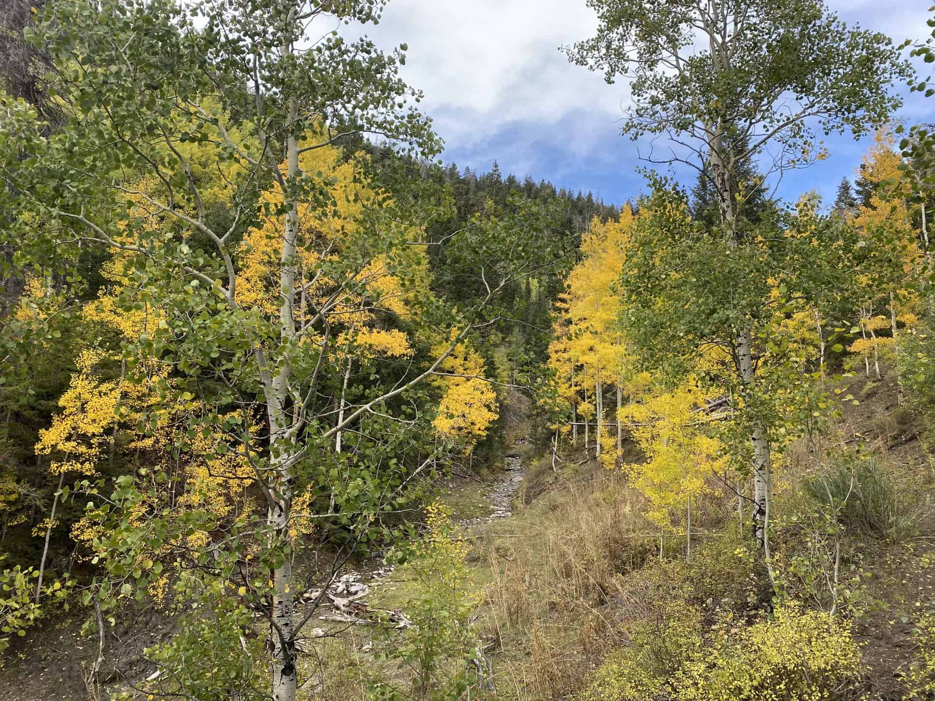
This property has steep terrain on both sides, with a canyon down the middle. The vegetation consists of forest-type conifer and aspen trees. A tributary stream runs through the property and into West Fork Willow Creek.
Acreage:
200.00 acres, more or less
Water Rights:
This property will include conveyance of two stock watering rights – WR #91-2382 and WR #91-2569.
Utilities:
No utilities are located on site.
Zoning:
A-10 (Agricultural)
Financing:
Financing will be offered for this parcel at a variable interest rate of prime plus 2.5% or 7.5%, whichever is greater. A down payment of 10% and closing costs will be due at the auction. The remaining balance can be financed for up to a 20 year term.
Mineral Lease Encumbrances:
None
Surface Lease Encumbrances:
Grazing Permit No. 22867-22, issued to Bar W Angus Company, LLC (the parcels from this sale will be removed from this permit when this property is sold)
Cultural Resource Covenant:
A cultural resource survey was conducted on this parcel. No significant sites were identified. The property will be sold without reservations for historical or cultural sites.
Disclosures:
- Please see the disclosure summary and the certificate of sale template document for general disclosures which apply to all parcels being offered for sale at this auction.
- All mineral rights will be reserved.
- The sand and gravel on the parcel will be subject to a royalty provision if sold commercially.
- The Utah Geological Survey has submitted the following comment: “Potential geologic hazards in the area that could affect the parcel include high slope instability potential, including possible active land sliding and landslide-prone geologic units, stream flooding, flash flooding/debris flow, problem soils and/or bedrock including shrink/swell and/or collapsible, shallow groundwater and bedrock, and indoor radon potential. Prospective buyers should be aware of the potential hazards so they can be addressed in a manner appropriate
to the intended use of the property. UGS has general geologic hazard information available at its offices and online at http://geology.utah.gov/utahgeo/hazards/index.htm.” - The property will be conveyed subject to all valid existing rights.

