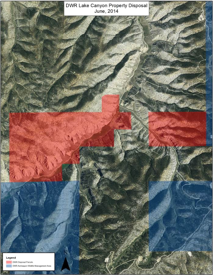
Lake Canyon (DWR Property)
STATEMENT FROM DWR (6/17/2014):
“After further consideration, the Lake Canyon land parcels owned by the Division of Wildlife Resources will not be included in the Trust Lands Administration auction on June 25. These parcels may be included in a future auction, but we need more time to evaluate them with our conservation and funding partners. We will provide advanced notice of any future auction dates.”
Legal Description:
The subject property is described as:
STATE OF UTAH, COUNTY OF DUCHESNE
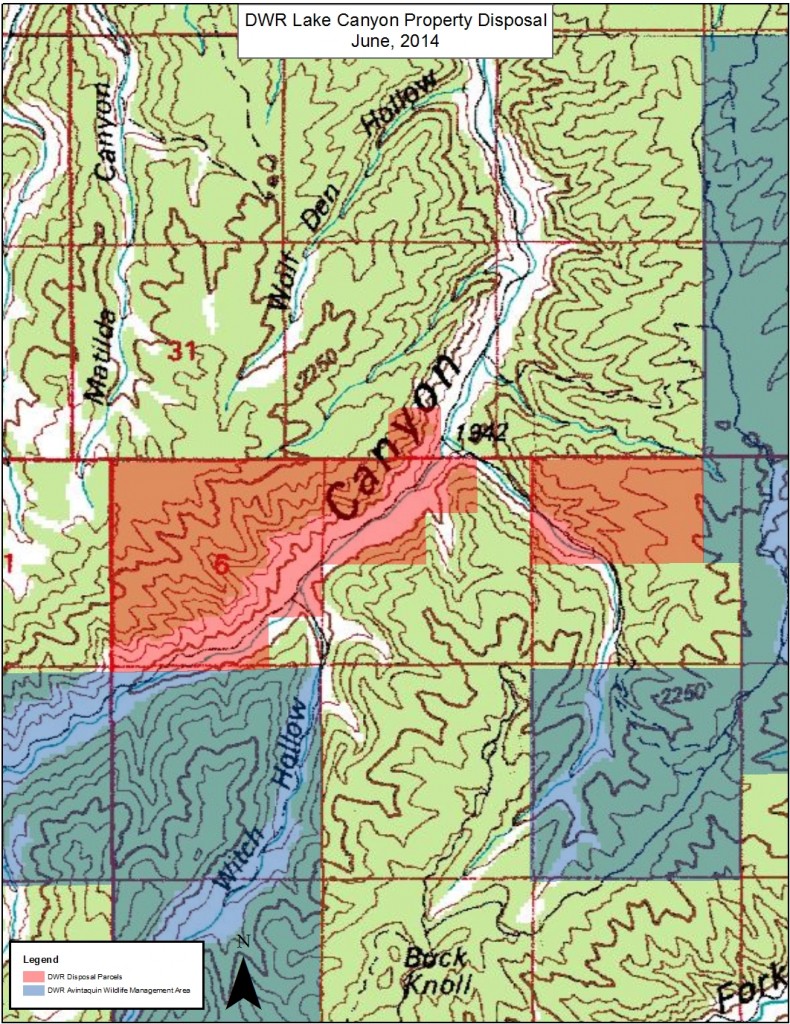
TOWNSHIP 5 SOUTH, RANGE 6 WEST, UINTAH SPECIAL BASE AND MERIDIAN:
SECTION 4: The North half,
less the following described parcel:
Beginning at the Northeast Corner of Section 4, Township 5 South, Range 6 West of the Uintah Special Base and Meridian (being monumented with a 3/4″ rebar with an aluminum cap stamped Timberline, LS 6028691, said rebar and aluminum cap bear S00°41’06″E 0.49 feet from the marked set stone monumenting the closing corner); thence S00°41’06″E along the East line of the Northeast Quarter of said Section 2566.55 feet to the East Quarter Corner of said Section (being monumented with a 3/4″ rebar with an aluminum cap stamped Timberline, LS 6028691); thence S89°25’59″W along the South line of said Northeast Quarter 944.67 feet to a point which bears S00°41’06″E parallel with said East line of the Northeast Quarter from the Southwest Corner of Section 34, Township 4 South, Range 6 West of the Uintah Special Base and Meridian (being a marked Set Stone); thence N00°41’06″W parallel with said East line of the Northeast Quarter of Section 4, 2575.53 feet to said Southwest Corner of Section 34; thence N89°58’41″E along the line common with said Sections 4 and 34, 944.73 feet to the point of beginning. Basis of bearings is said east line of the Northeast Quarter of Section 4 which is taken from Global Positioning Satellite observations to bear N00°41’06″W.
(Parcel 1)
SECTION 5: Lots 2 and 3; and the Southeast quarter of the Northwest quarter. The West half of the Northwest quarter.
(Parcel 2)
SECTION 6: The North half; and the Southwest quarter; and the North half of the Southeast quarter; and the Southwest quarter of the Southeast quarter.
(Parcel 3)
TOWNSHIP 4 SOUTH, RANGE 6 WEST, UINTAH SPECIAL BASE AND MERIDIAN:
SECTION 32: Lot 4 (being a part of the Southwest quarter Southeast quarter).
(Parcel 4)
Acreage:
1,070.00 Acres, More or Less
Property Description:
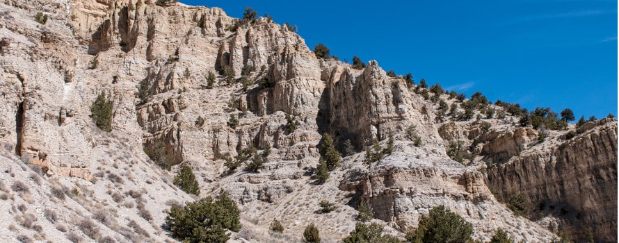
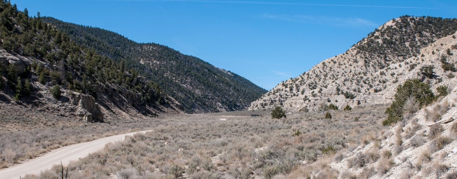
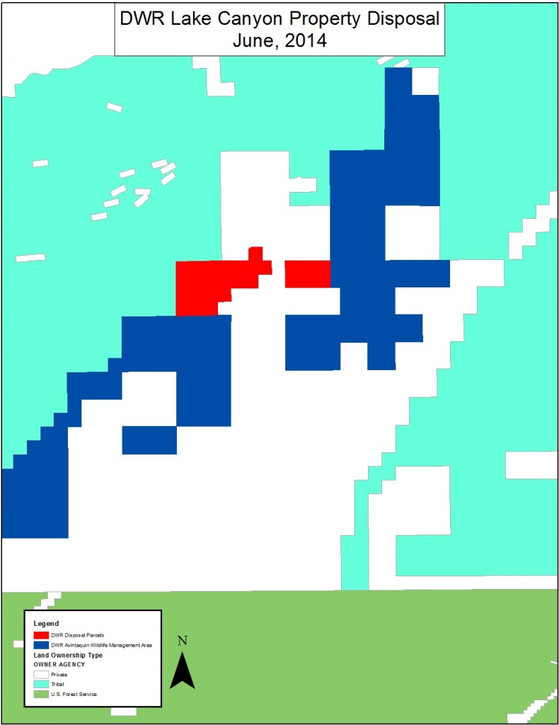
The Lake Canyon property is located in Duchesne County. Grasses, sagebrush, greasewood, rabbit-brush, are prevalent in areas along the Lake Canyon bottom. Pinyon and juniper trees are found on the drier slopes with western and southern aspects. Slopes with northern and eastern aspects host Douglas-fir trees.
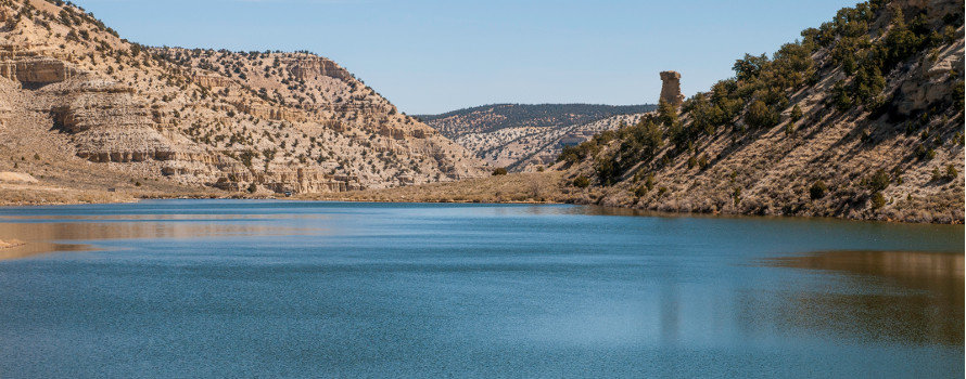
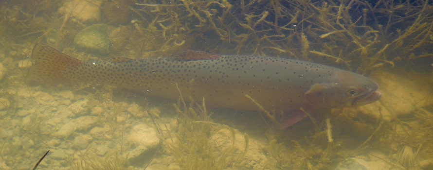
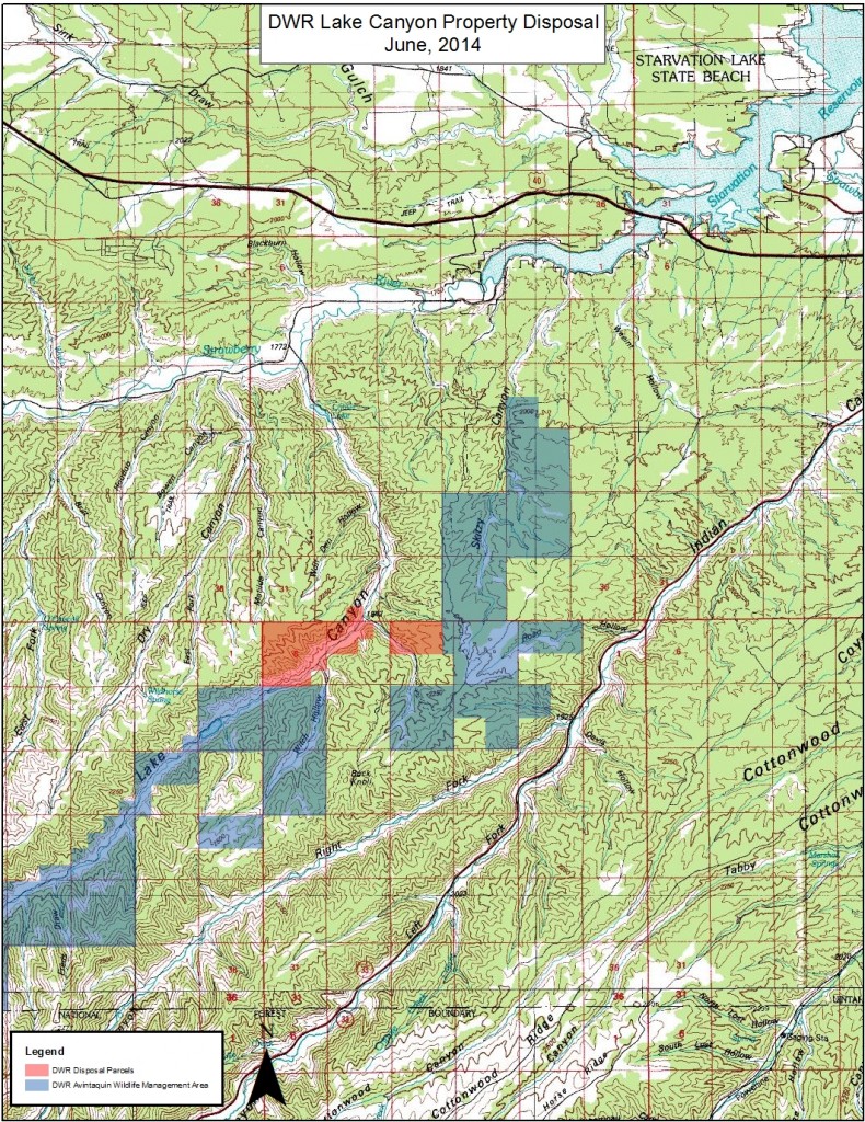
Several sites exist on the parcels that could be used for a recreational cabin and similar developments. The possibility for seasonal cattle grazing exists in the canyon bottom. There are a number of fishing opportunities nearby including the Strawberry River and Starvation Reservoir. Lake Canyon Lake, which contains Colorado River cutthroat, is approximately 1.25 miles to the southwest and is open to the public for fishing. The property is located in the well known Wasatch limited entry elk hunting unit and also offers general season deer hunting.
A Rocky Mountain bighorn sheep herd has been established to the south of the property on DWR’s Lake Canyon Wildlife Management Area and U.S. Forest Service property. Bighorn sheep can contract fatal diseases from domestic sheep and goats, and for this reason, DWR will retain a restrictive easement on the property precluding the keeping of domestic sheep, goats, and camelids.
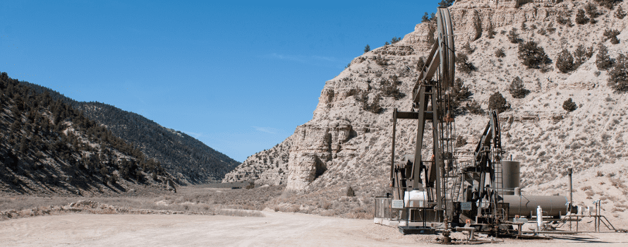
There are four producing oil and natural gas wells present. The first well is located 0.75 miles from the entrance of the property and east up Trail Canyon Road. The second well location is along the Lake Canyon Road and is 0.25 miles from the property entrance. The third and fourth well locations are also along the Lake Canyon Road and are 1.0 and 1.25 miles from the property entrance, respectively. DWR does not own the mineral rights, and so the mineral rights will not be conveyed with the property at auction.
Well-maintained Duchesne County roads are found in Lake Canyon, Trail Canyon, and Witch Hollow.
Directions to the Property:
From Duchesne Utah, travel west approximately 8.2 miles on US HWY40 to mile marker 78.5 and turn left on the Strawberry River Road. Continue south and west along the Strawberry River Road for 5.5 miles until reaching the Lake Canyon Road. Turn left onto the Lake Canyon Road and travel 5 miles south. A cattle guard, fence, and sign mark the entrance to the property.
The subject property is located downstream from Lake Canyon Lake approximately 5.4 miles southwest of Starvation Reservoir, and 9.5 miles southwest of the town of Duchesne, Utah, on Lake Canyon Road in unincorporated Duchesne County.
Water:
TBD
Minerals:
The mineral estate is not included with the property.
Utilities:
TBD
Zoning:
The property is zoned A-5, Agricultural, with a minimum lot size of 5 acres with a residence. The A-5, Agricultural zone is intended as a district in which the primary use of the land is agriculture. For additional information, please contact:
Michael A. Hyde, AICP
Community Development Administrator
PO Box 317
Duchesne, UT 84021-0317
Phone: 435-738-1151
Fax: 435-738-5522
Email: [email protected] for additional information.
Other:
TBD
Rights-of-Way/Easements:
Rights-of-way and easements of record are listed in Schedule B-2 of the accompanying Title Commitment. Upon request, DWR will provide copies of easements deeded during the period of DWR’s ownership.
DWR will retain a restrictive easement on the property precluding the keeping of domestic sheep and goats; and llamas, alpacas, and other camelids, on the property.
Financing:
FINANCING THROUGH THE STATE IS NOT AVAILABLE ON THIS PROPERTY. The property will be sold upon the following terms:
a. A deposit of at least 10% of the purchase price and all closing costs must be paid at the close of auction. Closing costs will include the following fees: $100.00 application fee; $400.00 sale processing charge; $5,650.00 for appraisal and appraisal review fees. Additional fees may be due. Check with the Trust Lands Administration for updates.
b. The purchaser will be required to pay the balance of the purchase price in full at a closing settlement on July 22, 2014.
c. Settlement will take place at Sunrise Title Company, 550 E. 200 N. 118-3, Roosevelt, UT, 84066; telephone number (435) 722-2257. Financing, if needed by the winning bidder, will need to be arranged by the bidder and the funds delivered to Sunrise Title Company within the alloted 15 business days. Failure to deliver the full purchase price to Sunrise Title Company within this period shall cause, at minimum, the deposit to be forfeited as damages.
