
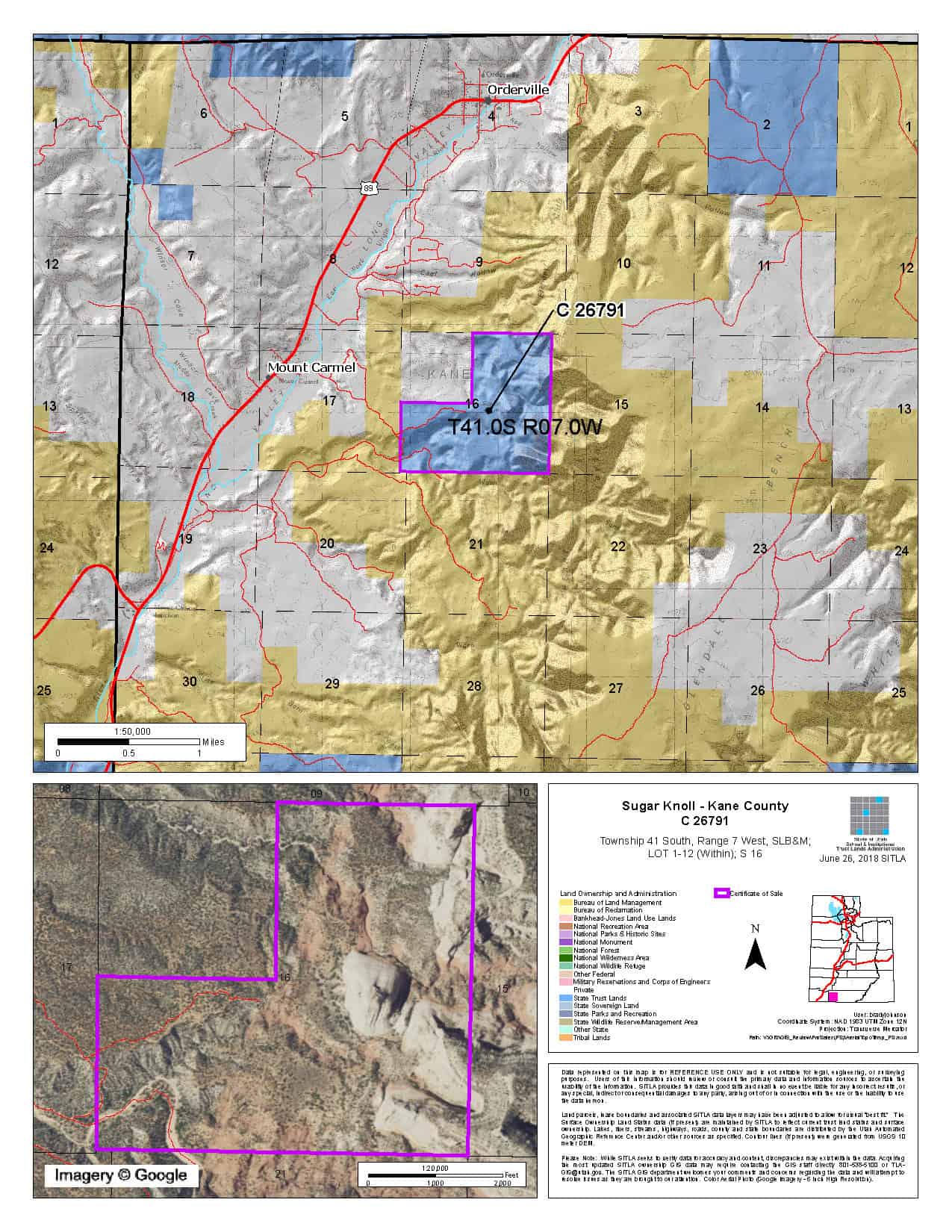
Sugar Knoll (C-26791)
Closing Costs:
These costs cannot be financed and are in addition to the 10% down payment. All closing costs are due from the prevailing bidder at the auction.
| Appraisal Costs: | $2,000.00 |
| Cultural Resources Survey: | TBD |
| Legal Advertising Cost: | TBD |
| Sale Processing Charge: | $500.00 |
| Application Fee: | $250.00 |
| TOTAL CLOSING COSTS: | TBD |
Beneficiary:
Public Schools
Legal Description:
Township 41 South, Range 7 West, SLB&M
Section 16: Lots 1-12
Location:
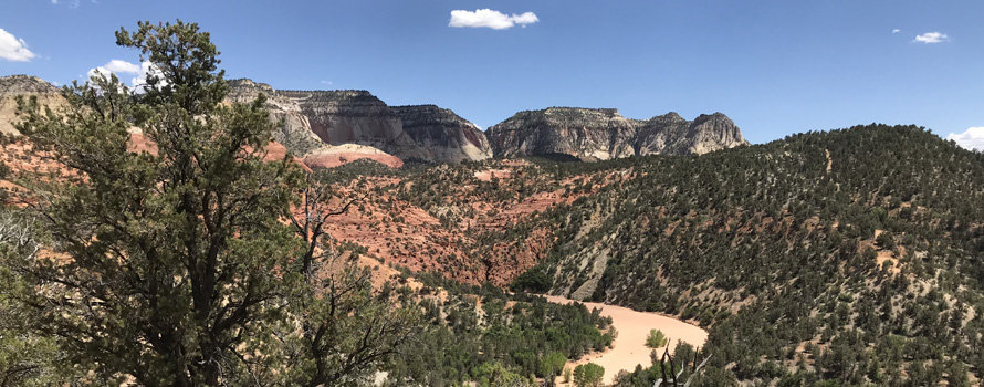
The parcel is located in Kane County, 14 miles east of Zion National Park and one mile off State Highway 89, near Mount Carmel Junction.
Access:
TBD
Other:
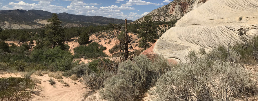
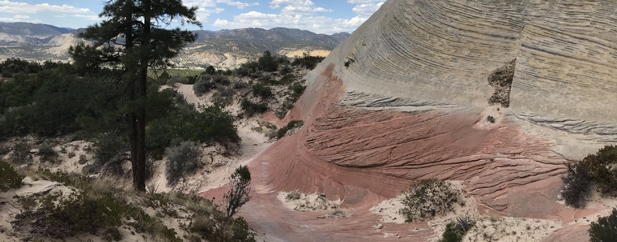
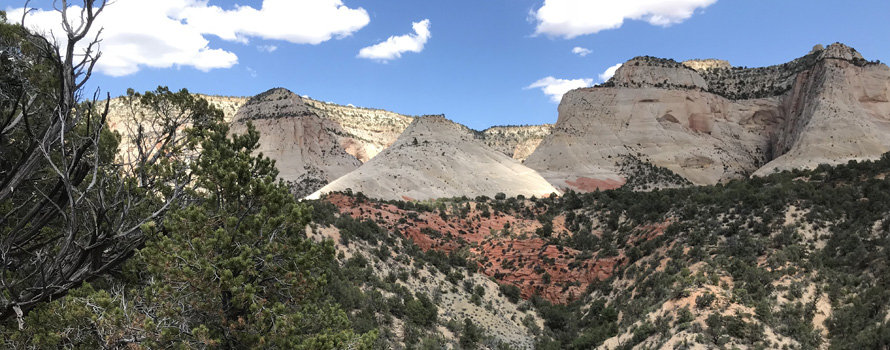
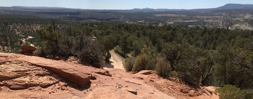
A beautiful sandstone feature named Sugar Knoll is located on this iconic, scenic, recreational property.
Acreage:
503.14 Acres, More or Less
Water:
TBD
Utilities:
There are no known utilities in the general area.
Zoning:
TBD
Financing:
Financing will be offered for this parcel. A down payment of 10% and closing costs will be due at the auction. The remaining balance can be financed at a variable rate of prime plus 2.5% for up to a 20 year term.
Mineral Leases:
None
Surface Leases:
- Easement No. 2016, issued to Kane County for roads for a perpetual term
- Right of Entry Permit No. 6526, issued to Red Desert Adventure / Eric Draper (this property will be deleted from this permit when sold)
- Right of Entry Permit No. 6559, issued to Zion Adventure Company (this property will be deleted from this permit when sold)
- Right of Entry Permit No. 6574, issued to East Zion Experiences, LLC (this property will be deleted from this permit when sold)
Cultural Resource Covenant:
A cultural resource survey will be conducted on the subject property. Any significant sites identified will be protected by covenant.
Disclosures:
- Please see the auction page for general disclosures and auction procedure information which pertains to all properties being offered at the auction.
- All mineral rights, including the sand and gravel rights will be reserved.
- The property will be conveyed subject to all valid existing rights.
- The following comment was received from the Utah Geological Survey (UGS): “Potential geologic hazards in the region that could affect the site include stream flooding, flash flooding/debris flow, problem soils including shrink/swell and/or collapsible, shallow bedrock, earthquake-related hazards associated with the Sevier/Toroweap fault zone, and indoor radon potential. Potential hazards should be addressed in a manner appropriate to the intended use of the property. Geologic hazards are best addressed early in the planning process prior to development and construction. UGS has general geologic hazard information available at its offices and online at http://geology.utah.gov/utahgeo/hazards/index.htm.”
- Other disclosures, if any, will be announced at the auction.

