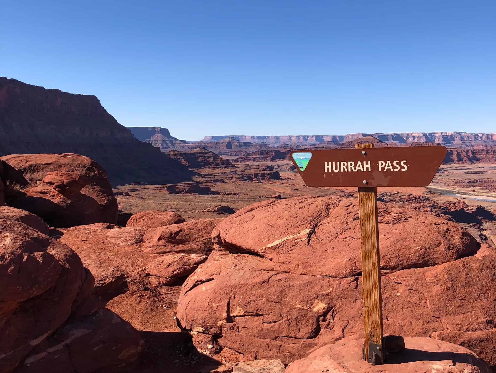
The Hurrah Pass 4WD Trail is one of Moab’s most popular trails, receiving tens of thousands of visits each year. It is a Class D road that leads to Chicken Corners and Lockhart Basin, which are also Class D roads.
This exceptionally scenic route has been degraded in recent years as a minority of OHV operators go off the route to climb banks above the trail or to reach the end of points below the trail (see photos). We intend to leave part of the points open as scenic spurs, but they need delineation to organize travel and prevent further sprawling. At the pass, we also intend to leave a half-acre accessible area for large groups to park.
Recently we scouted each of these spots with representatives from San Juan County, Moab Friends-For-Wheelin’, and Ride with Respect. Everyone agreed with the plans for the pass and scenic spurs, along with blocking the embankments to prevent climbing.
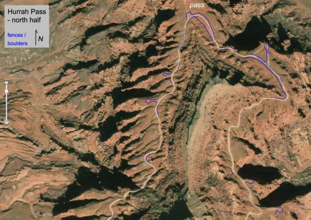 In the recent past, Trust Lands placed sign posts and temporary fences on some of these embankments, but it failed to stop off-trail travel. Therefore everyone on the field trip agreed that more substantial fences are needed. Where small boulders are available, which is the case at roughly half the spots, heavy equipment will be used to place boulders for an appearance that’s more natural than a fence would be. Where we must fence in front of viewpoints, the fence will be low profile to avoid obstructing the view.
The total length of lines that need to be blocked by a fence or small boulders is approximately 5,000 feet (see North and South maps showing anticipated placement). Around Hurrah Pass, most of the soil is shallow or nonexistent, which makes digging and equipment operation rough. From Moab, it takes an hour to reach Hurrah Pass.
The proliferation of off-trail tracks at this iconic location calls for a thorough response. Delineating the 4WD trail will benefit OHV riders by ensuring that it remains open for all kinds of recreation and that the scenery remains intact.
In the recent past, Trust Lands placed sign posts and temporary fences on some of these embankments, but it failed to stop off-trail travel. Therefore everyone on the field trip agreed that more substantial fences are needed. Where small boulders are available, which is the case at roughly half the spots, heavy equipment will be used to place boulders for an appearance that’s more natural than a fence would be. Where we must fence in front of viewpoints, the fence will be low profile to avoid obstructing the view.
The total length of lines that need to be blocked by a fence or small boulders is approximately 5,000 feet (see North and South maps showing anticipated placement). Around Hurrah Pass, most of the soil is shallow or nonexistent, which makes digging and equipment operation rough. From Moab, it takes an hour to reach Hurrah Pass.
The proliferation of off-trail tracks at this iconic location calls for a thorough response. Delineating the 4WD trail will benefit OHV riders by ensuring that it remains open for all kinds of recreation and that the scenery remains intact.