


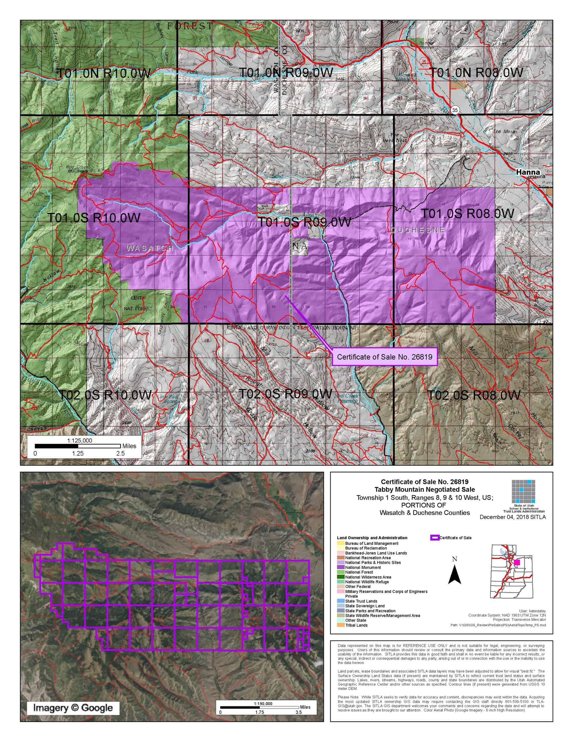
Tabby Mountain (C-26819)
Negotiated Sale Procedures:
Any party wishing to submit a competing offer for this property must submit a letter of interest on or before Thursday, January 31, 2019. More information on the negotiated sale process and how competing offers may be presented will be sent to those who timely submit letters of interest.
CLOSING COSTS:
These costs are in addition to the sale price (a cultural resource survey will be required if the property is purchased by a non-governmental entity):
| Appraisal Costs: | $11,200.00 |
| Cultural Resources Survey: | $250,000.00 |
| Legal Advertising Cost: | $7,000.00 |
| Sale Processing Charge: | $500.00 |
| Application Fee: | $250.00 |
| TOTAL CLOSING COSTS: | $268,950.00 |
Beneficiaries:
Public Schools, Utah State University, Reservoirs, Normal School, School of Mines, Miner’s Hospital
Legal Description:
All or part of these sections:
Township 1 South, Range 8 West, USM
Sections 16-21, 28-33
Township 1 South, Range 9 West, USM
Sections 13-36
Township 1 South, Range 10 West, USM
Sections 9-16, 22-27, 36
Location:
This parcel straddles Wasatch and Duchesne Counties in Northeastern Utah. It is approximately 2 hours from Salt Lake City, Utah to Tabiona, Utah.
Access:
Good access exists throughout the parcel on several county roads.
Other:
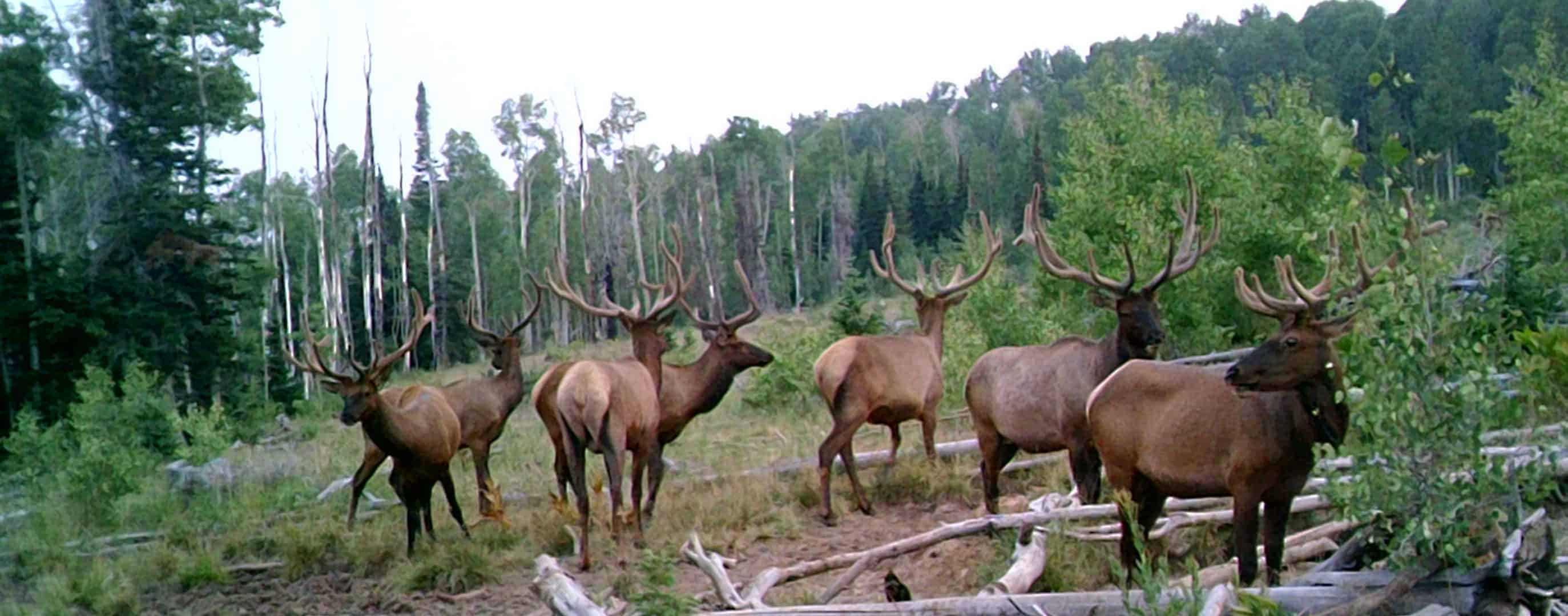
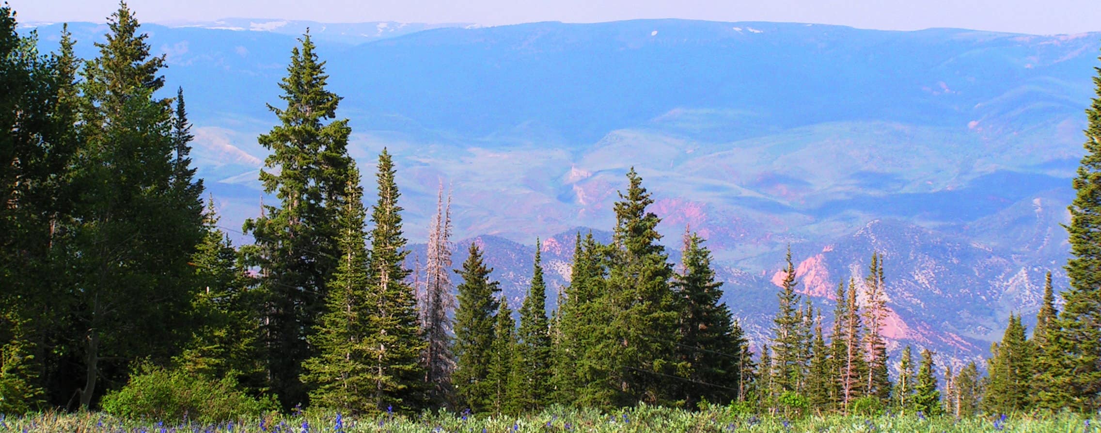
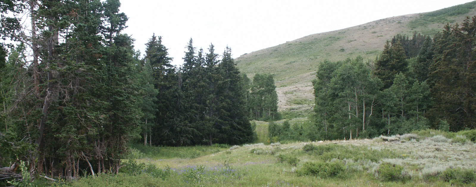
The Utah Department of Natural Resources (DNR) has petitioned the Utah School and Institutional Trust Lands Administration (SITLA) for the opportunity to purchase SITLA property at Tabby Mountain, west of Tabiona in Wasatch and Duchesne Counties. This premier mountain property in northeastern Utah has great recreation opportunities and supports abundant wildlife, timber, and domestic livestock grazing resources. It is located adjacent to US Forest Service property, a Utah Wildlife Management Area, and private ranch properties managed as cooperative wildlife management hunting units.
Acreage:
28,482.11 Acres, More or Less
Water:
The following water rights will be conveyed to the successful purchaser of the property (56.00 acre-feet of diligence claims and 17.528 acre-feet of certificated rights):
43-51 – Mill Hollow – Diligence
43-52 – Tabby Creek – Diligence
43-53 – Unnamed tributary to Rabbit Gulch – Diligence
43-54 – Spring Hollow – Diligence
43-1514 – Grass Hollow – Diligence
43-1547 – Unnamed tributary to Red Creek – Diligence
43-1548 – Unnamed tributary to Red Creek – Diligence
43-1595 – Red Creek – Diligence
43-1597 – Log Hollow – Diligence
43-1602 – Unnamed tributary to Red Creek – Diligence
43-1955 – Red Creek Spring – Diligence
43-2448 – Red Creek – Diligence
43-6940 – Unnamed tributary to Red Creek – Diligence
43-8418 – Max Wall Memorial Spring – Certificated
43-10808 – Max Wall Memorial Spring – Certificated
43-10833 – Max Wall Memorial Spring – Certificated
43-10879 – Max Wall Memorial Spring – Certificated
43-10880 – Max Wall Memorial Spring – Certificated
43-10989 – Max Wall Memorial Spring – Certificated
43-10990 – Max Wall Memorial Spring – Certificated
Utilities:
Power lines are in place serving telecommunication sites. No water or sewer utilities are present.
Zoning:
The portions of the property within Wasatch County are zoned P-160. The portions of the property within Duchesne County would be zoned upon sale; adjacent private properties are zoned Ag 5 Acre and Ag 2.5 Acre.
Financing:
Financing will not be offered for this parcel.
Finder’s Fee and/or Broker’s Fee:
For this sale, a finder’s fee or a broker’s fee must be paid by the purchaser.
Mineral Leases:
None – The mineral estate is not owned by SITLA.
Surface Leases:
- Grazing Permit No. 22546-11 for a grazing permit to Red Creek Cattle Association (this permit may be canceled upon sale)
- Easement No. 2236 for roads to Duchesne County
- Easement No. 2241 for roads to Wasatch County
- Predesignation No. 827, issued to USDA Forest Service for Coleman Basin Road Management
- Right of Way No. 1047 for a water pipeline to Leon Carey
- Right of Way No. 1048 for a translator site to Duchesne County
- Right of Way No. 1062 for roads to Duchesne County
- Right of Way No. 1093 for roads to Wasatch County
- Right of Way No. 1192 for a water pipeline to The Red Creek Development Corporation
- Right of Way No. 1491 for a powerline to Moon Lake Electric Association
- Special Use Lease Agreement No. 381 for telecommunications to Utah Communications Authority
- Special Use Lease Agreement No. 384 for telecommunications to Moon Lake Electric Association
- Special Use Lease Agreement No. 1376 for telecommunications to MK Communication, Inc.
- Special Use Lease Agreement No. 1417 for telecommunications to Union Telephone Company, Inc.
- Special Use Lease Agreement No. 1817 for telecommunications to Uintah Basin Electronics Telecommunications, LLC
- Special Use Lease Agreement No. 1825 for commercial use to Reid Ranch, LLC
- Timber Sale No. 874 to Defa’s Sawmill
- Timber Sale No. 876 to The Church of Jesus Christ of Latter-Day Saints
- Timber Sale No. 878-01 to Paul M. Young Construction, Inc.
Cultural Resource Covenant:
A cultural resource (archaeological) survey will be required if the property is purchased by a non-governmental entity. Cost for the survey will be $250,000.00. This amount must be submitted as part of the closing costs.
Disclosures:
- The property will be conveyed subject to all valid existing rights.
- The following comments were received from the Division of Drinking Water: “The Drinking Water source protection for 07003WS001 and 07003WS002, Tabiona Town Water System Upper and Lower Springs are within the purchase area. Please keep these vulnerable areas in mind as projects move forward in the area.”

