
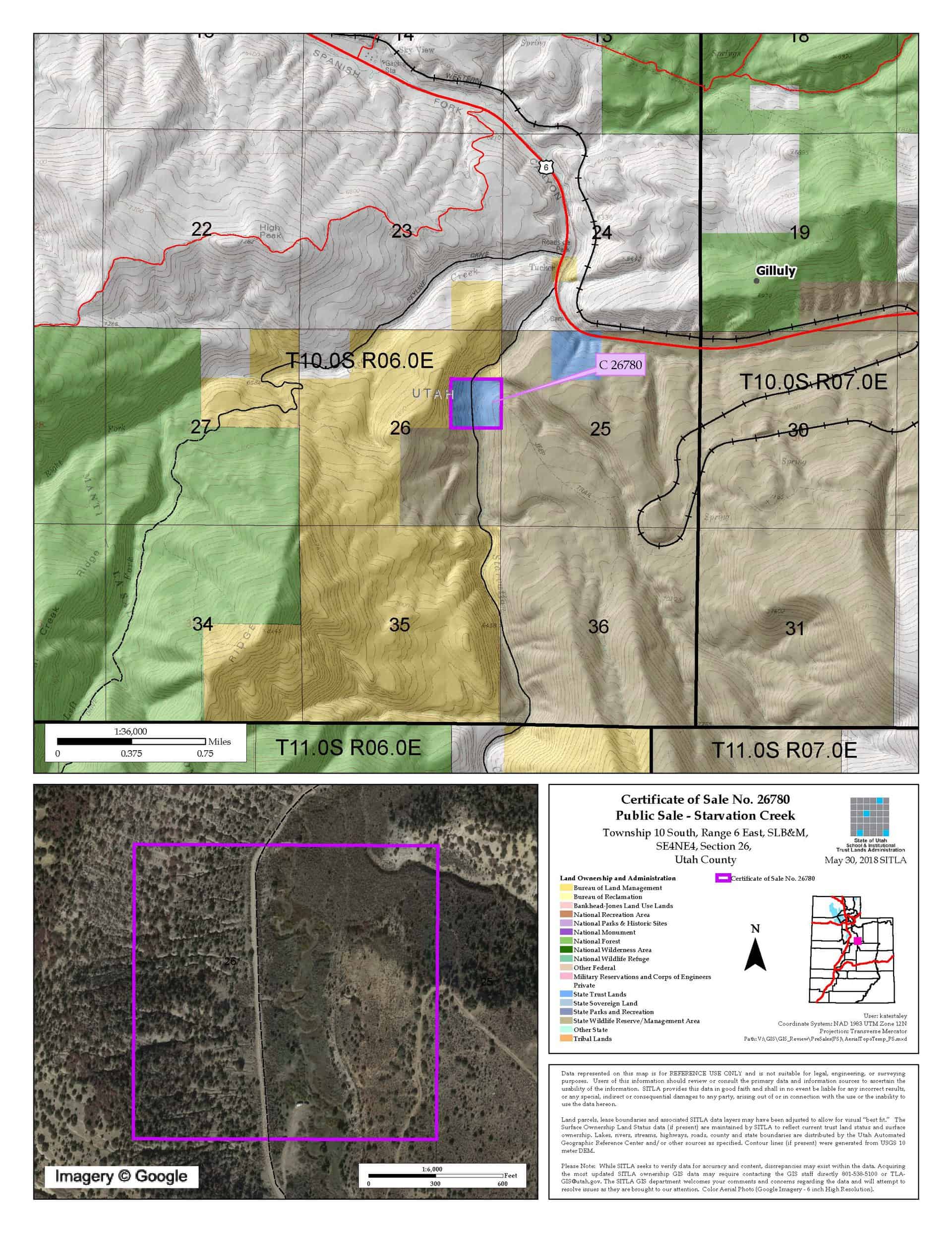
Starvation Creek (C-26780)
ONLINE BIDDING INFORMATION:
Bid Start Time: Thursday, November 12, 2020 at 10am
Bid End Time: Wednesday, November 18, 2020 at 3pm
Closing Costs:
These costs cannot be financed and are in addition to the 10% down payment. All closing costs are due from the prevailing bidder at the auction.
| Appraisal Costs: | $1,800.00 |
| Cultural Resources Survey: | $700.00 |
| Legal Advertising Cost: | $200.00 |
| Sale Processing Charge: | $500.00 |
| Application Fee: | $250.00 |
| TOTAL CLOSING COSTS: | $3,450.00 |
Beneficiary:
The net proceeds from the sale of this property will be deposited into the permanent fund for the beneficiary of the School for the Deaf.
Legal Description:
Township 10 South, Range 6 East, SLB&M
Section 26: SE¼NE¼
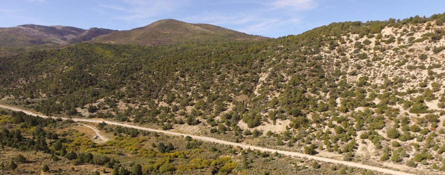
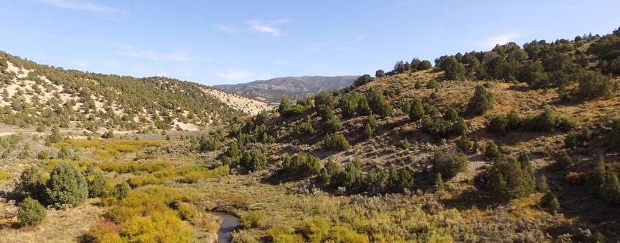
Location:
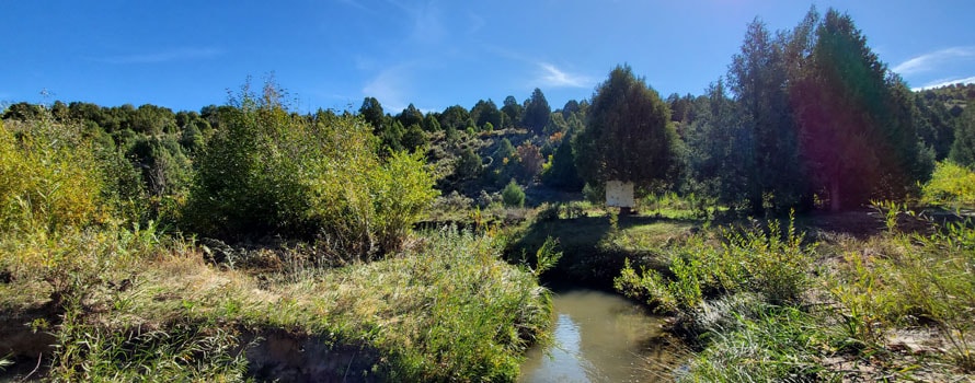
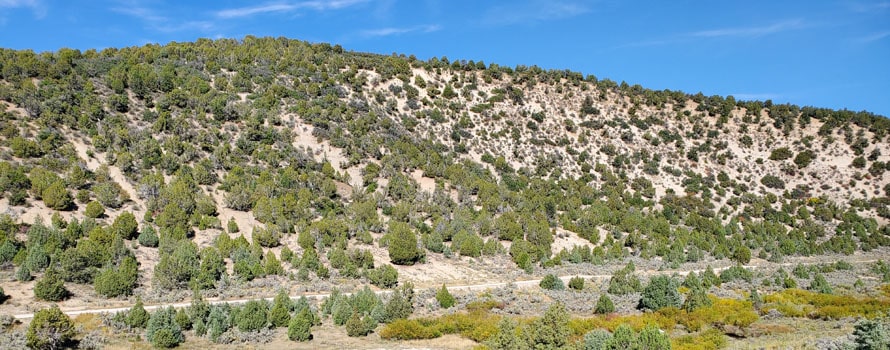
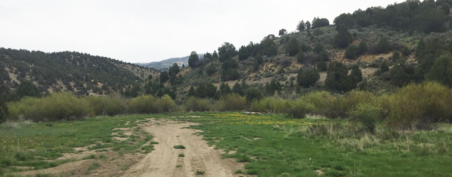
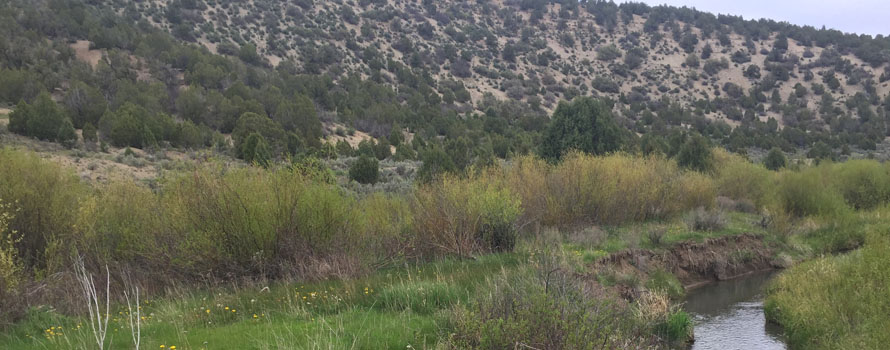
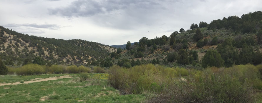
The parcel is located 1 mile off of Highway 6, near the Skyline Drive, which is a popular off-highway vehicle route. The property is bisected by Starvation Creek and a Class D public road (Starvation Road).
Access:
The property has good access from a Class D public road (Starvation Road) which bisects the parcel.
Other:
The topography of the parcel includes partially sloping side hills with a lower flat area where Starvation Creek flows through the property. The property is a popular camping site through each summer and fall. The surrounding landowners are the Bureau of Land Management, the US Forest Service, and the Utah Division of Wildlife Resources.
Acreage:
40.00 Acres, More or Less
Water:
None
Utilities:
None
Zoning:
This parcel is zoned Mining and Grazing which has a minimum lot size of 50 acres required for a single family dwelling.
Financing:
Financing will be offered for this parcel. A down payment of 10% and closing costs will be due at the auction. The remaining balance can be financed at a variable rate of prime plus 2.5% for up to a 20 year term.
Mineral Leases:
None
Surface Leases:
- Easement No. 2218, for roads, issued to Utah County, for a perpetual term
- Easement No. 2223, for a fiber optic line, issued to Centracom, with an expiration date of February 14, 2049
- Predesignation No. 784, for roads, issued to Utah County for a perpetual term
Cultural Resource Covenant:
A cultural resource survey was conducted on the subject property. No significant sites were identified. The property will be sold without any historic reservations.
Disclosures:
- Please see the disclosure summary and the certificate of sale template document posted at the bottom of this page for general disclosures which apply to all parcels being offered for sale at this auction.
- All mineral rights, including the sand and gravel rights will be reserved.
- The following comment was received from the Utah Geological Survey (UGS): Potential geologic hazards in the area that could affect the property include flash flooding/debris flow, problem soils including shrink/swell and/or collapsible, shallow bedrock, and indoor radon potential. Prospective users should be aware of the potential hazards so they can be addressed in a manner appropriate to the intended use of the property. UGS has general geologic hazard information available at its offices and online at http://geology.utah.gov/utahgeo/hazards/index.htm.
- The property will be conveyed subject to all valid existing rights.

